MyTopo
Fish Lake Montana US Topo Map
Couldn't load pickup availability
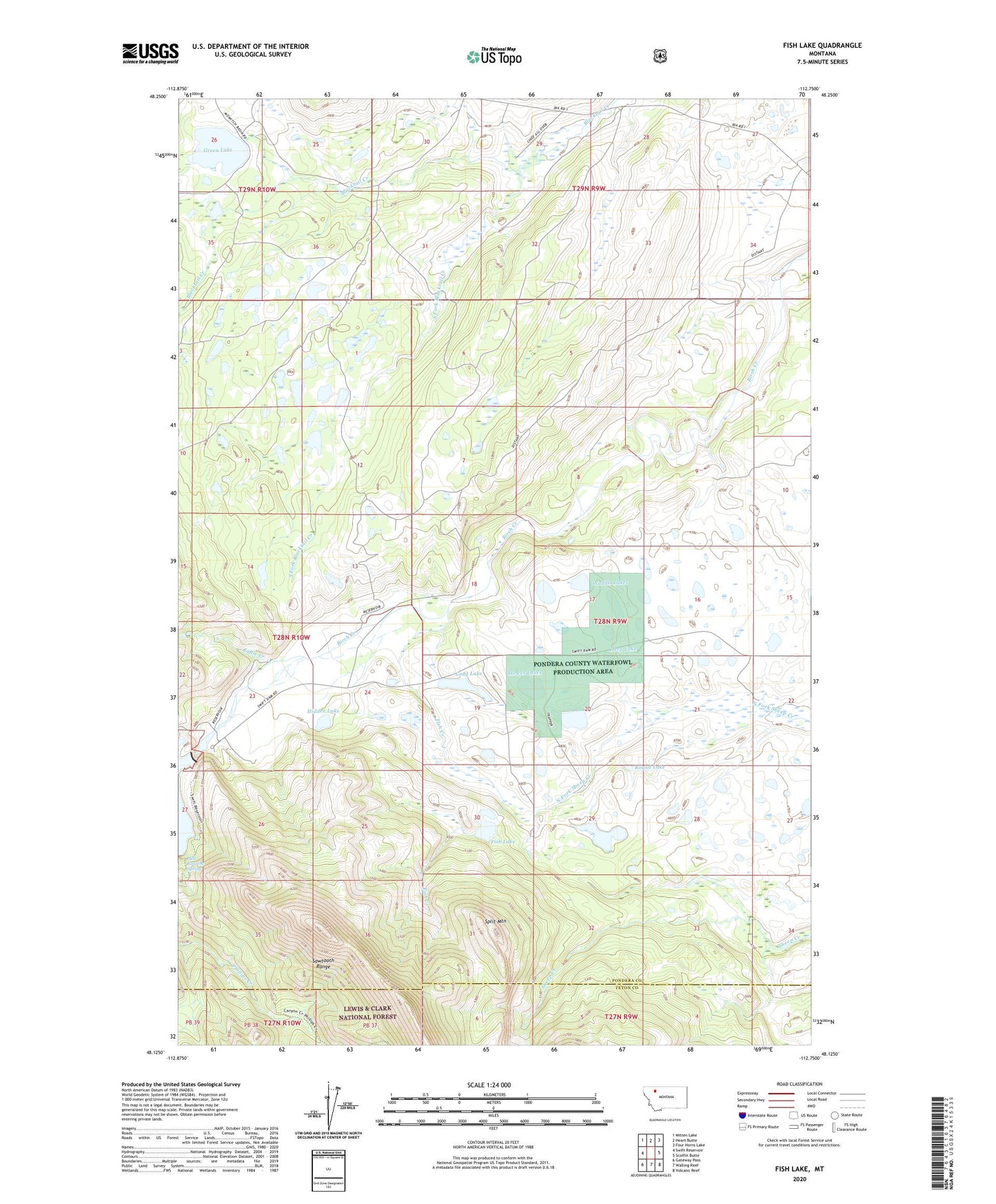
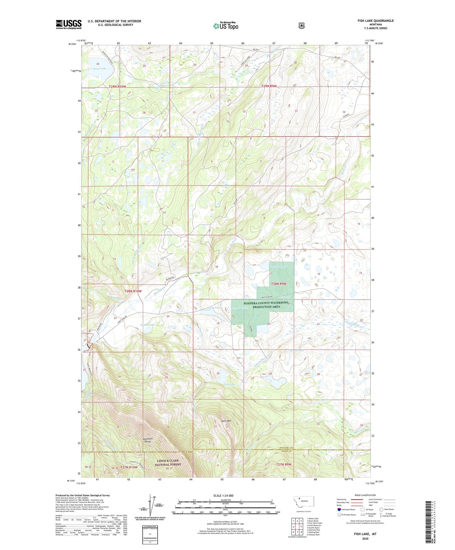
2020 topographic map quadrangle Fish Lake in the state of Montana. Scale: 1:24000. Based on the newly updated USGS 7.5' US Topo map series, this map is in the following counties: Pondera, Teton. The map contains contour data, water features, and other items you are used to seeing on USGS maps, but also has updated roads and other features. This is the next generation of topographic maps. Printed on high-quality waterproof paper with UV fade-resistant inks.
Quads adjacent to this one:
West: Swift Reservoir
Northwest: Mitten Lake
North: Heart Butte
Northeast: Four Horns Lake
East: Scoffin Butte
Southeast: Volcano Reef
South: Walling Reef
Southwest: Gateway Pass
Contains the following named places: Cody Lake, Deep Lake, Eagle Creek, Fish Creek, Fish Lake, Fish Lake Dam, Fish Lake School, Floating Rib Dam, Green Lake, Green Lake Dam, Hell Roaring Spring, Hidden Lake, Howes Lakes, Miller Ditch, Pondera County Waterfowl Production Area, Round Lake, South Fork Blacktail Creek, Split Mountain, Swift Dam, Swift Dam Trailhead, Twin Lake Dam, Twin Lakes, Waddel Lakes