MyTopo
Mitten Lake Montana US Topo Map
Couldn't load pickup availability
Also explore the Mitten Lake Forest Service Topo of this same quad for updated USFS data
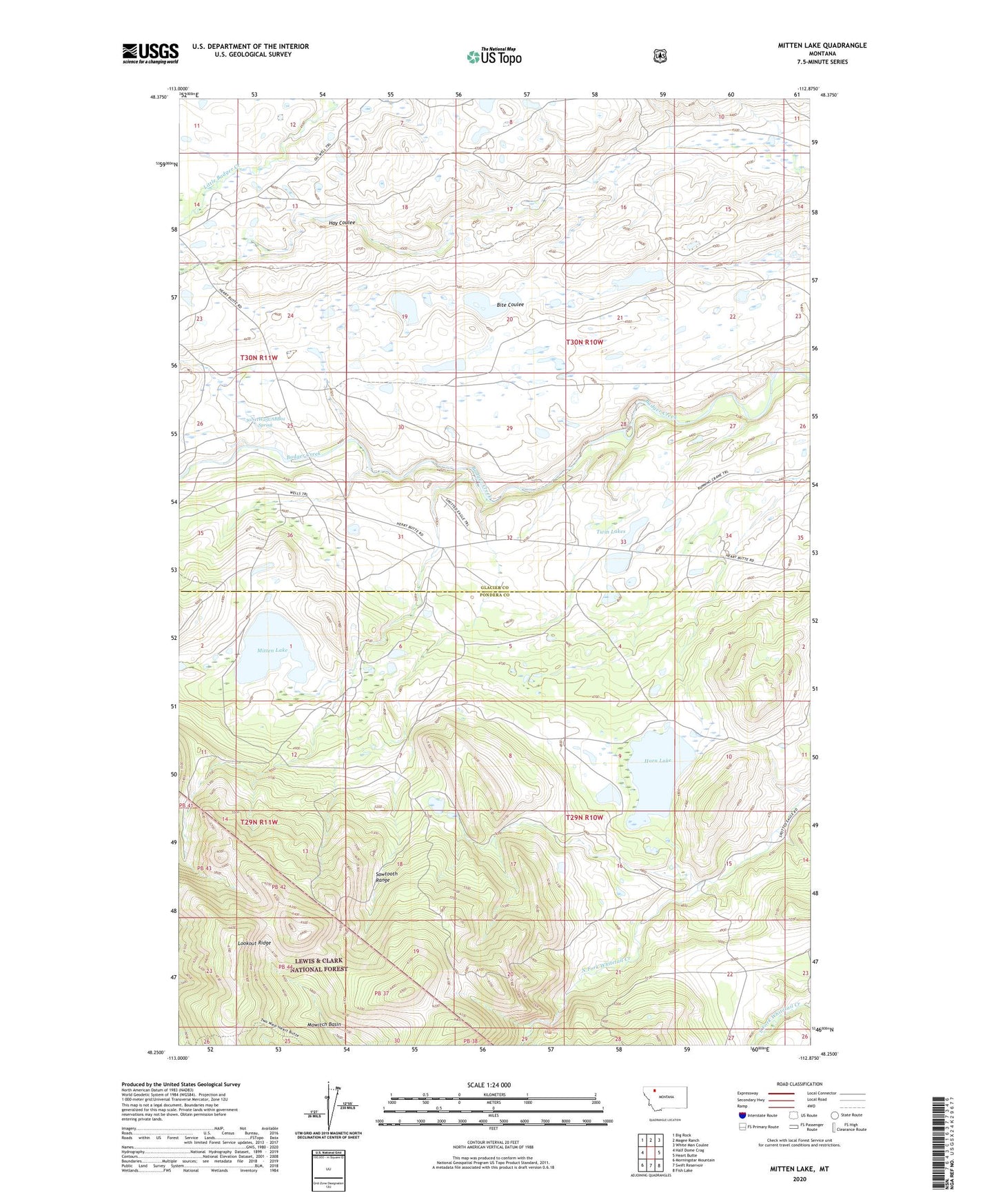
2024 topographic map quadrangle Mitten Lake in the state of Montana. Scale: 1:24000. Based on the newly updated USGS 7.5' US Topo map series, this map is in the following counties: Glacier, Pondera. The map contains contour data, water features, and other items you are used to seeing on USGS maps, but also has updated roads and other features. This is the next generation of topographic maps. Printed on high-quality waterproof paper with UV fade-resistant inks.
Quads adjacent to this one:
West: Half Dome Crag
Northwest: Big Rock
North: Magee Ranch
Northeast: White Man Coulee
East: Heart Butte
Southeast: Fish Lake
South: Swift Reservoir
Southwest: Morningstar Mountain
This map covers the same area as the classic USGS quad with code o48112c8.
Contains the following named places: 30N11W25CABB01 Spring, Horn Lake, Lookout Ridge, Mitten Lake, Mowitch Basin, Swims Under School, Twin Lakes