MyTopo
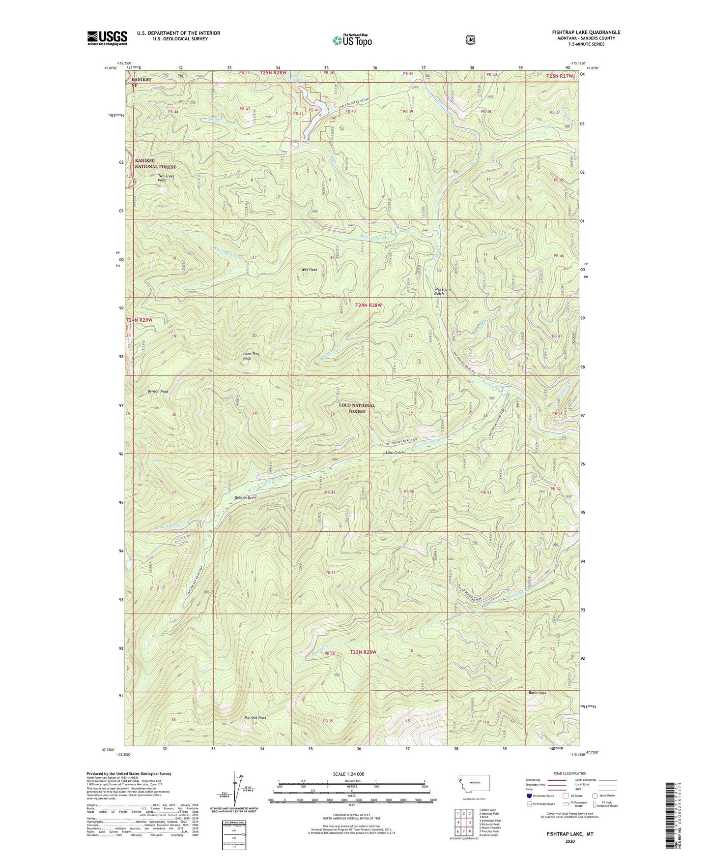
Fishtrap Lake Montana US Topo Map
Couldn't load pickup availability
Also explore the Fishtrap Lake Forest Service Topo of this same quad for updated USFS data
2024 topographic map quadrangle Fishtrap Lake in the state of Montana. Scale: 1:24000. Based on the newly updated USGS 7.5' US Topo map series, this map is in the following counties: Sanders. The map contains contour data, water features, and other items you are used to seeing on USGS maps, but also has updated roads and other features. This is the next generation of topographic maps. Printed on high-quality waterproof paper with UV fade-resistant inks.
Quads adjacent to this one:
West: Vermilion Peak
Northwest: Miller Lake
North: Mantrap Fork
Northeast: Bend
East: Richards Peak
Southeast: Calico Creek
South: Priscilla Peak
Southwest: Mount Headley
This map covers the same area as the classic USGS quad with code o47115g2.
Contains the following named places: Basin Peak, Beartrap Fork, Benson Draw, Benson Peak, Cool Creek, Daisy Creek, Fishtrap Campground, Fishtrap Lake, Fishtrap Lake Recreation Site, Fishtrap Work Center, Little Creek, Lone Tree Peak, Lulu Gulch, Marmot Peak, Radio Creek, Shale Creek, Shorthorn Gulch, Stony Lake Creek, Thompson River Mount Headley Trail, Two Trees Point, Wee Peak, West Fork Fishtrap Creek, West Fork Fishtrap Trail, Whiteface Creek