MyTopo
Fitzpatrick Lake Montana US Topo Map
Couldn't load pickup availability
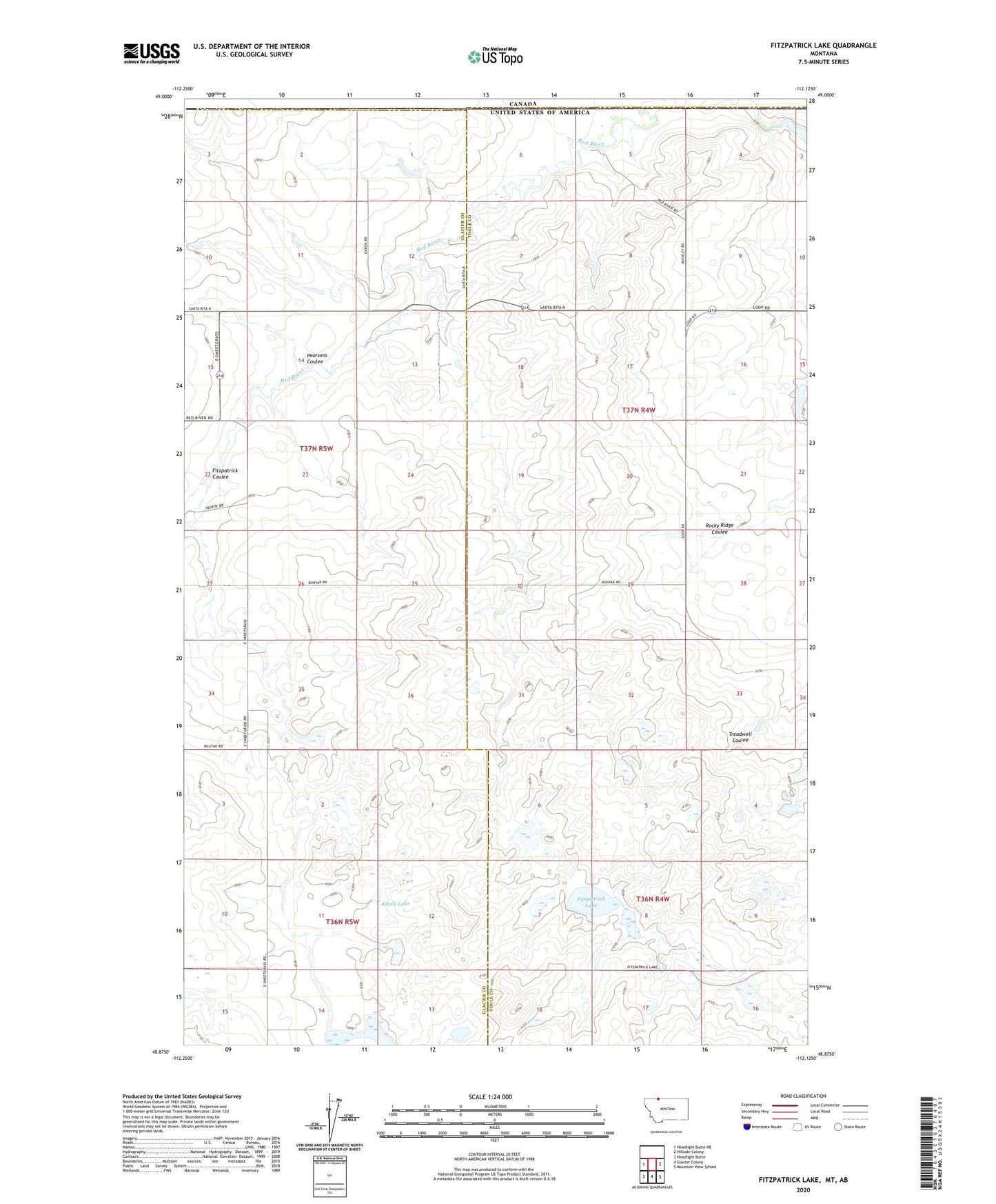
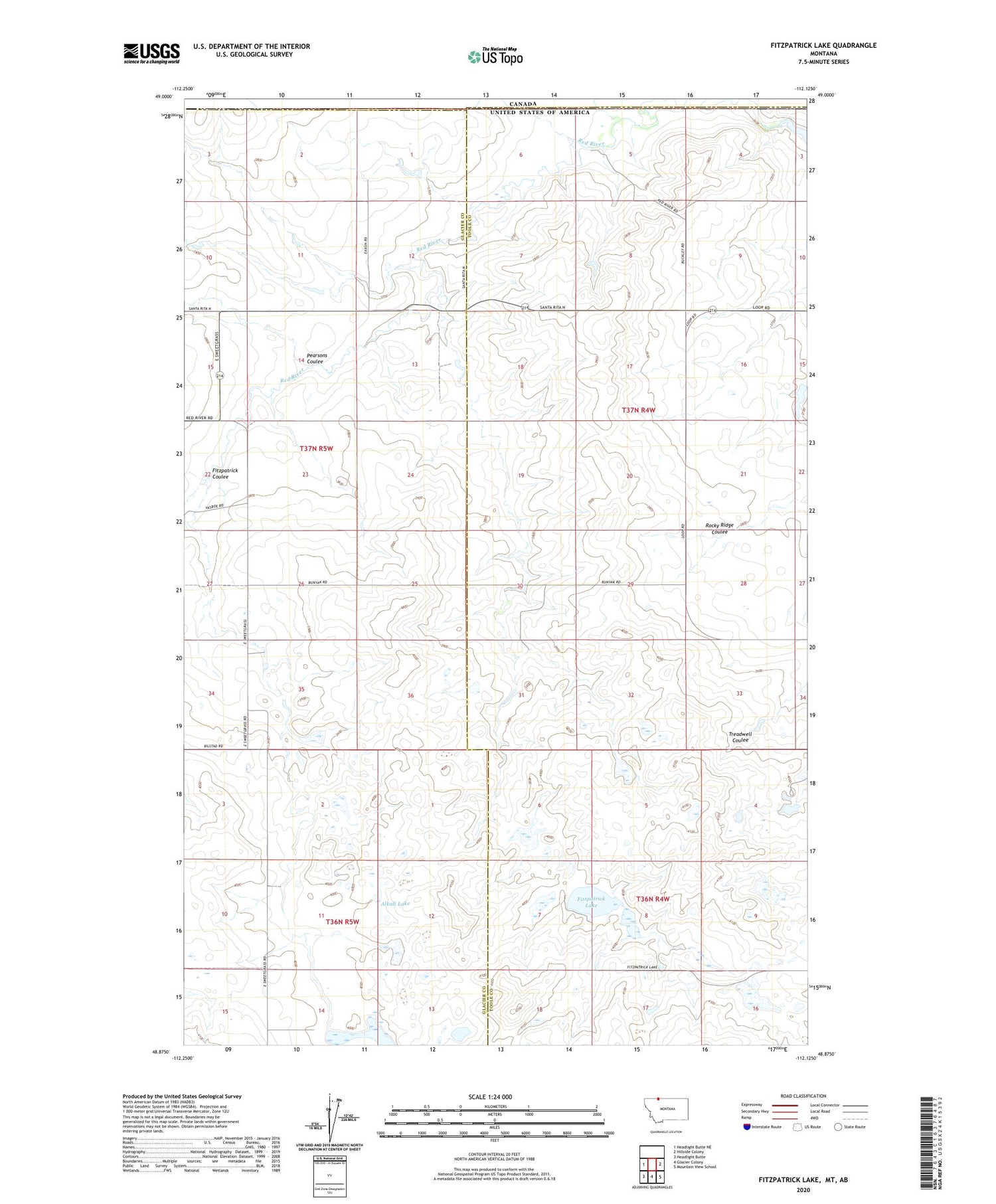
2020 topographic map quadrangle Fitzpatrick Lake in the state of Montana. Scale: 1:24000. Based on the newly updated USGS 7.5' US Topo map series, this map is in the following counties: Toole, Glacier. The map contains contour data, water features, and other items you are used to seeing on USGS maps, but also has updated roads and other features. This is the next generation of topographic maps. Printed on high-quality waterproof paper with UV fade-resistant inks.
Quads adjacent to this one:
West: Headlight Butte NE
East: Hillside Colony
Southeast: Mountain View School
South: Glacier Colony
Southwest: Headlight Butte
Contains the following named places: 36N04W04AA__01 Well, 36N04W07AC__01 Well, 36N04W09BB__01 Well, 36N05W01DCCC01 Well, 36N05W11BA__01 Well, 36N05W12AC__01 Well, 36N05W12DC__01 Well, 36N05W13AA__01 Well, 36N05W14AC__01 Well, 36N05W14BD__01 Well, 37N04W05CB__01 Well, 37N04W05CBAD01 Well, 37N04W18BBAC01 Well, 37N04W18CC__01 Well, 37N04W28DC__01 Well, 37N04W29DA__01 Well, 37N04W29DB__01 Well, 37N04W31AC__01 Well, 37N05W10DC__01 Well, 37N05W12AA__01 Well, 37N05W13AD__01 Well, 37N05W15DA__01 Well, 37N05W24BA__01 Well, 37N05W26CB__01 Well, 37N05W34AD__01 Well, 37N05W34DD__01 Well, 37N05W34DD__02 Well, 37N05W35CD__01 Well, Alkali Lake, Demers, Demers Post Office, Fitzpatrick Coulee, Fitzpatrick Lake, Pearsons Coulee, Ramcharger Dam, Red Creek Oil Field