MyTopo
Headlight Butte NE Montana US Topo Map
Couldn't load pickup availability
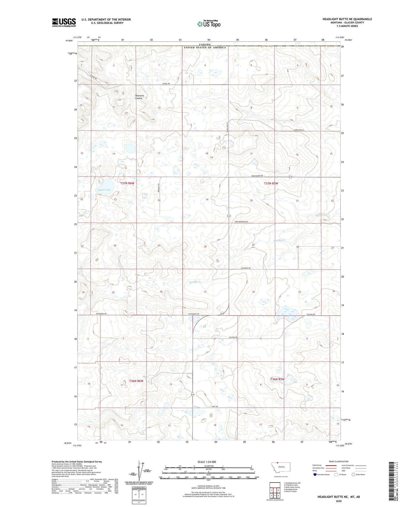
2024 topographic map quadrangle Headlight Butte NE in the state of Montana. Scale: 1:24000. Based on the newly updated USGS 7.5' US Topo map series, this map is in the following counties: Glacier. The map contains contour data, water features, and other items you are used to seeing on USGS maps, but also has updated roads and other features. This is the next generation of topographic maps. Printed on high-quality waterproof paper with UV fade-resistant inks.
Quads adjacent to this one:
West: Headlight Butte NW
East: Fitzpatrick Lake
Southeast: Glacier Colony
South: Headlight Butte
Southwest: Dead Indian Spring
This map covers the same area as the classic USGS quad with code o48112h3.
Contains the following named places: 36N05W04AB__01 Well, 36N05W04DB__01 Well, 36N05W09BC__01 Well, 36N05W17BA__01 Well, 36N06W02DA__01 Well, 36N06W12AC__01 Well, 36N06W12BC__01 Well, 36N06W13AA__01 Well, 36N06W14BA__01 Well, 37N05W06CB__01 Well, 37N05W07AD__01 Well, 37N05W08DD__01 Well, 37N05W19DA__01 Well, 37N05W20DC__01 Well, 37N05W21AB__01 Well, 37N05W29DD__01 Well, 37N05W30DD__01 Well, 37N06W01CB__01 Well, 37N06W03DA__01 Well, 37N06W24AB__01 Well, 37N06W24CD__01 Well, 37N06W24CD__02 Well, 37N06W26AC__01 Well, 37N06W35CB__01 Well, 37N06W36DD__01 Well, Korner, Korner Post Office, Lukins Lake, Red River School, Tsadi Dam, Upsilon Dam, Vasboe Dam