MyTopo
Headlight Butte Montana US Topo Map
Couldn't load pickup availability
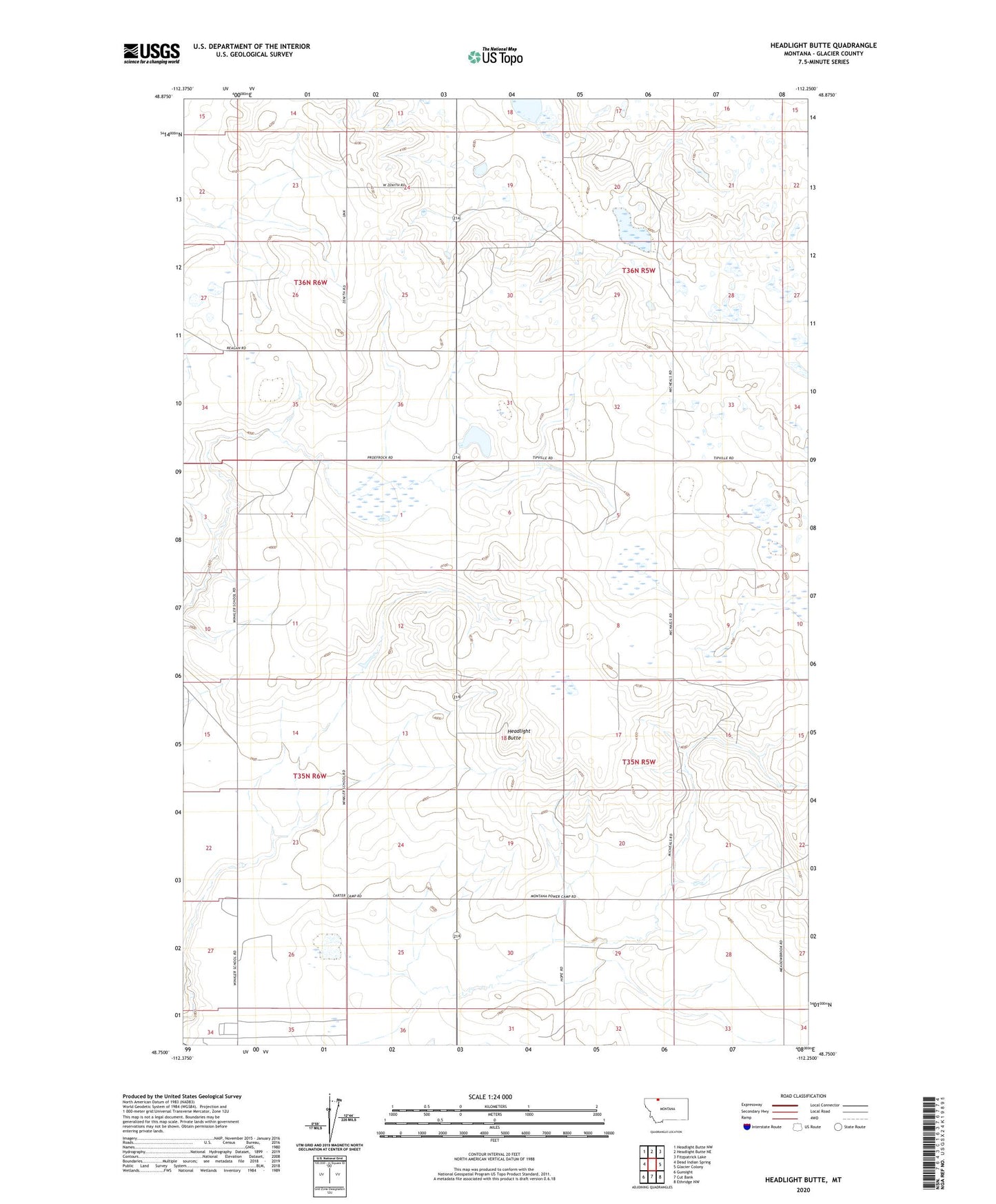
2024 topographic map quadrangle Headlight Butte in the state of Montana. Scale: 1:24000. Based on the newly updated USGS 7.5' US Topo map series, this map is in the following counties: Glacier. The map contains contour data, water features, and other items you are used to seeing on USGS maps, but also has updated roads and other features. This is the next generation of topographic maps. Printed on high-quality waterproof paper with UV fade-resistant inks.
Quads adjacent to this one:
West: Dead Indian Spring
Northwest: Headlight Butte NW
North: Headlight Butte NE
Northeast: Fitzpatrick Lake
East: Glacier Colony
Southeast: Ethridge NW
South: Cut Bank
Southwest: Gunsight
This map covers the same area as the classic USGS quad with code o48112g3.
Contains the following named places: 35N05W04AA__01 Well, 35N05W05AD__01 Well, 35N05W05DD__01 Well, 35N05W05DDD_01 Well, 35N05W07BB__01 Well, 35N05W07CC__01 Well, 35N05W16AC__01 Well, 35N05W19CB__01 Well, 35N05W20BB__01 Well, 35N05W20BB__02 Well, 35N05W20DC__01 Well, 35N05W21DA__01 Well, 35N05W22CB__01 Well, 35N05W22CB__02 Well, 35N05W27CC__01 Well, 35N05W30AD__01 Well, 35N05W34BB__01 Well, 35N05W34BB__02 Well, 35N06W02AA__01 Well, 35N06W02DD__01 Well, 35N06W11CB__01 Well, 35N06W12CC__01 Well, 35N06W14CB__01 Well, 35N06W23CD__01 Well, 35N06W26CD__01 Well, 36N05W19BC__01 Well, 36N05W31BC__01 Well, 36N05W32BC__01 Well, 36N05W33BC__01 Well, 36N05W33CBBC01 Well, 36N06W25DD__01 Well, 36N06W34DD__01 Well, 36N06W35DA__01 Well, 36N06W35DC__01 Well, Cut Bank Division, Headlight Butte, Omicron Dam, Tipville, Whetstone Camp, Zenith Colony, Zenith Colony Census Designated Place