
MyTopo
Flat Top Butte NE Montana US Topo Map
Couldn't load pickup availability
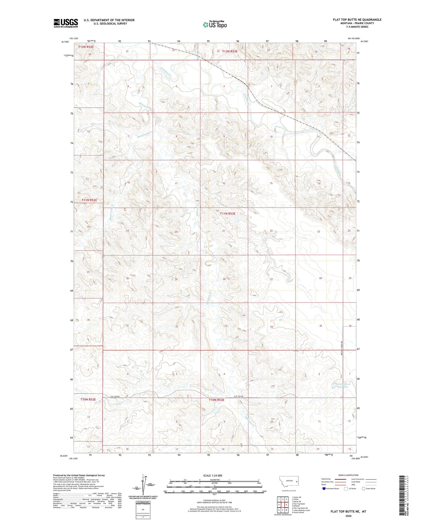
2020 topographic map quadrangle Flat Top Butte NE in the state of Montana. Scale: 1:24000. Based on the newly updated USGS 7.5' US Topo map series, this map is in the following counties: Prairie. The map contains contour data, water features, and other items you are used to seeing on USGS maps, but also has updated roads and other features. This is the next generation of topographic maps. Printed on high-quality waterproof paper with UV fade-resistant inks.
Quads adjacent to this one:
West: Flat Top Butte
Northwest: Fallon SW
North: Fallon
Northeast: Marsh SW
East: Mildred
Southeast: Loony Hollow
South: Little Whitney Creek
Southwest: Flat Top Butte SW
Contains the following named places: 11N53E01CCAC01 Well, 11N53E07DC__01 Well, 11N53E15ADDA01 Well, 11N53E28CABB01 Well, 11N53E33BA__01 Well, Airport Reservoir, Bar-G School, Dunwoodie Creek, Evertz Ranch, Fort Whitney, Fox Creek, Hyde Number 2 Dam, Powers-Wade School, Shumaker Number 2 Dam, Terry South Division, Thirteen Flat School, Wade School, Whitney, Whitney Creek, Whitney Post Office, Whitney School


