MyTopo
Marsh SW Montana US Topo Map
Couldn't load pickup availability
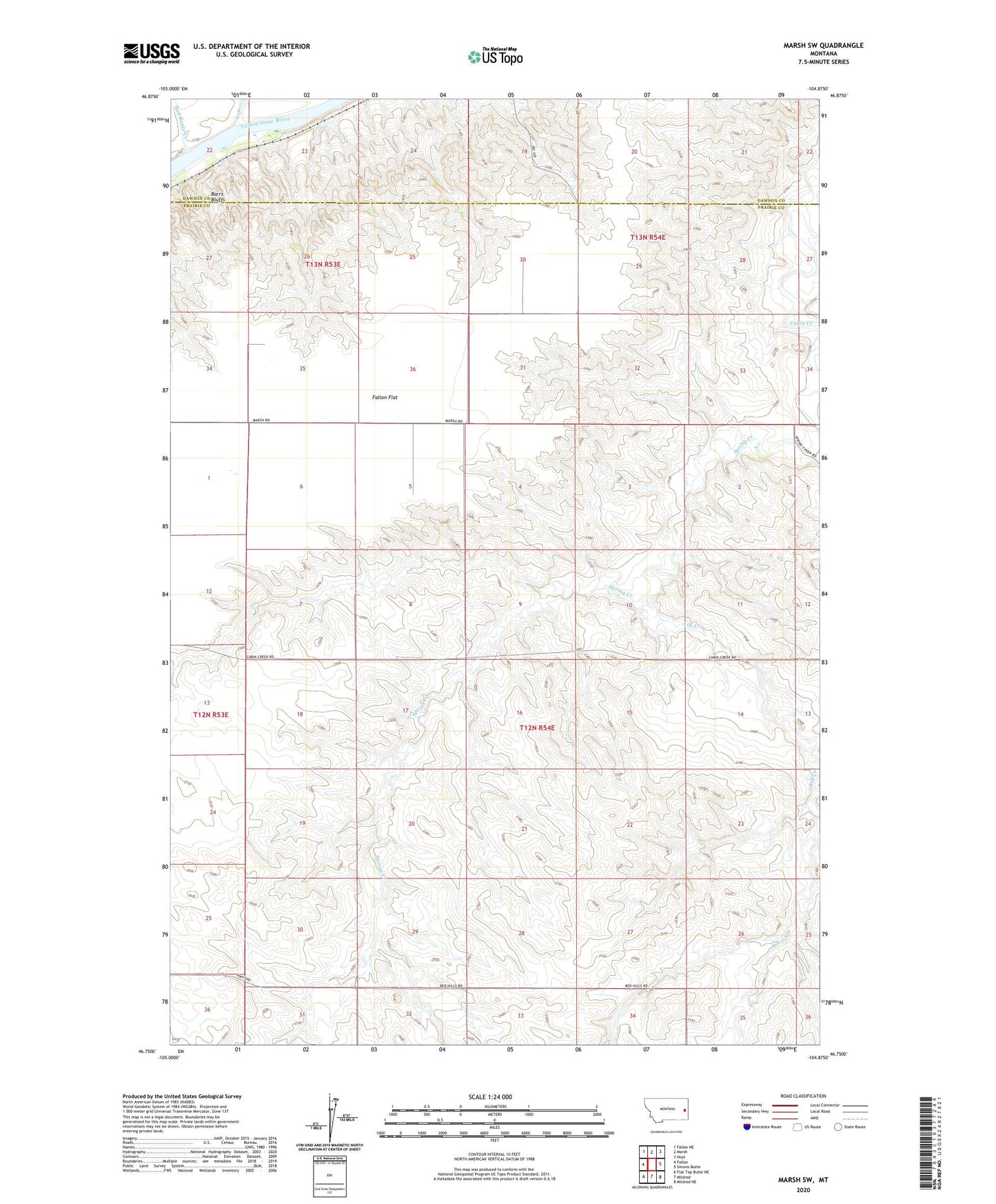
2024 topographic map quadrangle Marsh SW in the state of Montana. Scale: 1:24000. Based on the newly updated USGS 7.5' US Topo map series, this map is in the following counties: Prairie, Dawson. The map contains contour data, water features, and other items you are used to seeing on USGS maps, but also has updated roads and other features. This is the next generation of topographic maps. Printed on high-quality waterproof paper with UV fade-resistant inks.
Quads adjacent to this one:
West: Fallon
Northwest: Fallon NE
North: Marsh
Northeast: Hoyt
East: Simons Butte
Southeast: Mildred NE
South: Mildred
Southwest: Flat Top Butte NE
This map covers the same area as the classic USGS quad with code o46104g8.
Contains the following named places: 12N54E02AA__01 Well, 12N54E10DADB01 Well, 12N54E17ACAD01 Well, 13N53E22AAB_01 Well, 13N53E22ABC_01 Well, 13N53E22BAC_02 Well, Ash Creek, Bad Route Creek, Buechler School, Conlin, Conlin Post Office, DeWald School, Garvin School, Jones School