MyTopo
Loony Hollow Montana US Topo Map
Couldn't load pickup availability
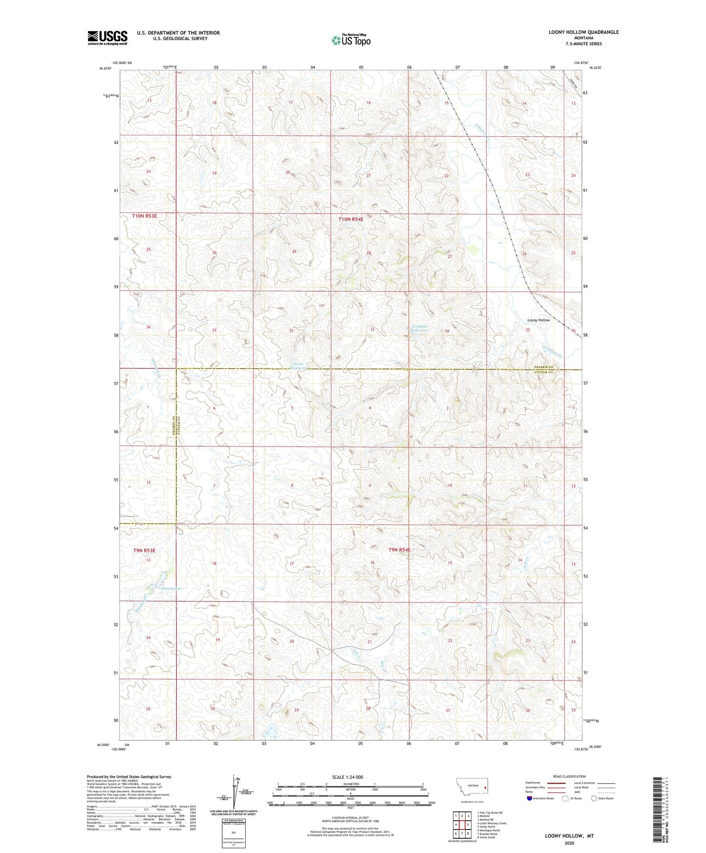
2024 topographic map quadrangle Loony Hollow in the state of Montana. Scale: 1:24000. Based on the newly updated USGS 7.5' US Topo map series, this map is in the following counties: Custer, Prairie. The map contains contour data, water features, and other items you are used to seeing on USGS maps, but also has updated roads and other features. This is the next generation of topographic maps. Printed on high-quality waterproof paper with UV fade-resistant inks.
Quads adjacent to this one:
West: Little Whitney Creek
Northwest: Flat Top Butte NE
North: Mildred
Northeast: Mildred NE
East: Ismay North
Southeast: Ismay South
South: Bracket Butte
Southwest: Montague Butte
This map covers the same area as the classic USGS quad with code o46104e8.
Contains the following named places: 09N54E29DA__01 Well, 10N54E19AC__01 Well, 10N54E22DDCB01 Well, 10N54E29DACB01 Well, 10N54E30ADDB01 Well, Archdale Reservoir, Dry Creek, Gray Number 1 Dam, Horse Reservoir, Lacomb Siding, Loony Hollow, Marshall Dam, Shoemaker