MyTopo
Fort Belknap Agency Montana US Topo Map
Couldn't load pickup availability
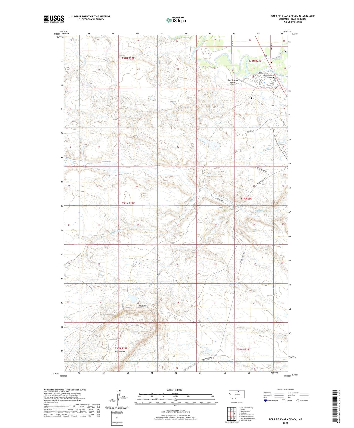
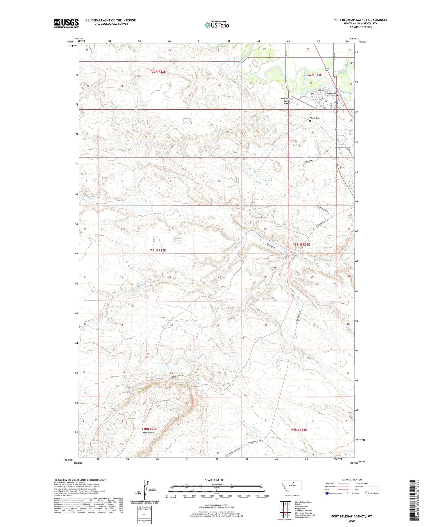
2020 topographic map quadrangle Fort Belknap Agency in the state of Montana. Scale: 1:24000. Based on the newly updated USGS 7.5' US Topo map series, this map is in the following counties: Blaine. The map contains contour data, water features, and other items you are used to seeing on USGS maps, but also has updated roads and other features. This is the next generation of topographic maps. Printed on high-quality waterproof paper with UV fade-resistant inks.
Quads adjacent to this one:
West: Big Coulee
Northwest: Fort Belknap Siding
North: Harlem
Northeast: Grable Coulee
East: Threemile Reservoir
Southeast: Wild Horse Butte
South: Fort Belknap Agency SE
Southwest: Newhouse Reservoir
Contains the following named places: 31N23E04BBDD01 Well, 31N23E05ADDC01 Well, 31N23E05DDDC01 Well, 31N23E09CACA01 Well, 31N23E18ACDC01 Well, Agency Cemetery, Fort Belknap Agency, Fort Belknap Agency Airport, Fort Belknap Boarding School, Fort Belknap College, Fort Belknap Community Church, Fort Belknap Critical Care Hospital, Fort Belknap Police Department, Fort Belknap Reservation Historical Marker, Fort Belknap Rest Area, Fort Belknap Sewage Lagoon Dam, Fort Belknap Volunteer Fire Department Agency Group, Indian Bathtub Dam, Newtown, Pictorial Museum, Snake Butte Reservoir Dam, Vision Quest Historical Marker