MyTopo
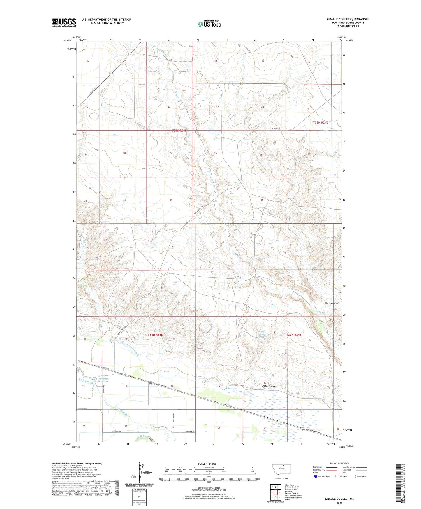
Grable Coulee Montana US Topo Map
Couldn't load pickup availability
2024 topographic map quadrangle Grable Coulee in the state of Montana. Scale: 1:24000. Based on the newly updated USGS 7.5' US Topo map series, this map is in the following counties: Blaine. The map contains contour data, water features, and other items you are used to seeing on USGS maps, but also has updated roads and other features. This is the next generation of topographic maps. Printed on high-quality waterproof paper with UV fade-resistant inks.
Quads adjacent to this one:
West: Harlem
Northwest: East Butte
North: Wayne Creek NW
Northeast: Hornbeck Lake
East: Wayne Creek SE
Southeast: Savoy
South: Threemile Reservoir
Southwest: Fort Belknap Agency
This map covers the same area as the classic USGS quad with code o48108e6.
Contains the following named places: Beaver Dam, BR-52 Dam, Grable Coulee, Grable Coulee Spring, Grabtak Dam, Harts Coulee, Matador, Thirthmile Reservoir Dam, Thirtymile Reservoir, West Fork Wayne Creek