MyTopo
Wild Horse Butte Montana US Topo Map
Couldn't load pickup availability
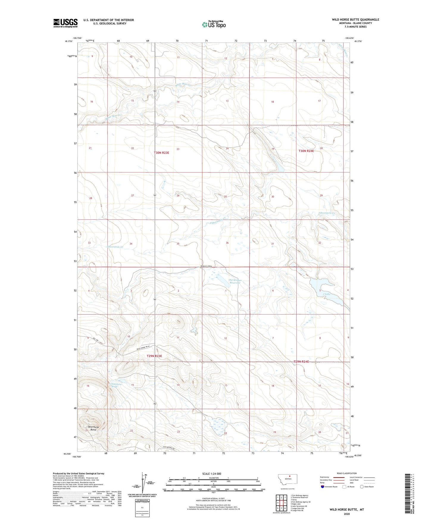
2024 topographic map quadrangle Wild Horse Butte in the state of Montana. Scale: 1:24000. Based on the newly updated USGS 7.5' US Topo map series, this map is in the following counties: Blaine. The map contains contour data, water features, and other items you are used to seeing on USGS maps, but also has updated roads and other features. This is the next generation of topographic maps. Printed on high-quality waterproof paper with UV fade-resistant inks.
Quads adjacent to this one:
West: Fort Belknap Agency SE
Northwest: Fort Belknap Agency
North: Threemile Reservoir
Northeast: Savoy
East: Bigby Lake
Southeast: Lodge Pole NE
South: Lodge Pole NW
Southwest: Lake Seventeen NE
This map covers the same area as the classic USGS quad with code o48108c6.
Contains the following named places: 29N23E02ABAD01 Well, Agency District, Fort Belknap Number 41 Dam, Fort Belknap Number 42 Dam, Fort Belknap Number 43 Dam, J Lake, J Lake Dam, Old Woman Reservoir, Wild Horse Butte, Wild Horse Spring