MyTopo
Threemile Reservoir Montana US Topo Map
Couldn't load pickup availability
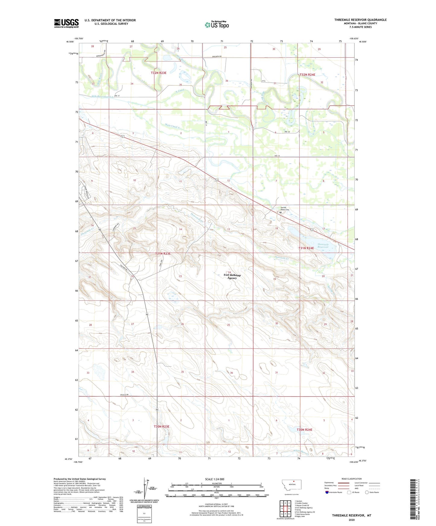
2024 topographic map quadrangle Threemile Reservoir in the state of Montana. Scale: 1:24000. Based on the newly updated USGS 7.5' US Topo map series, this map is in the following counties: Blaine. The map contains contour data, water features, and other items you are used to seeing on USGS maps, but also has updated roads and other features. This is the next generation of topographic maps. Printed on high-quality waterproof paper with UV fade-resistant inks.
Quads adjacent to this one:
West: Fort Belknap Agency
Northwest: Harlem
North: Grable Coulee
Northeast: Wayne Creek SE
East: Savoy
Southeast: Bigby Lake
South: Wild Horse Butte
Southwest: Fort Belknap Agency SE
This map covers the same area as the classic USGS quad with code o48108d6.
Contains the following named places: 31N23E01ABCD01 Well, 31N23E03BCCC01 Well, 31N23E03CAAB01 Well, 31N23E03CABA01 Well, 31N23E04CDA_01 Well, 31N23E12DBBC01 Well, 31N24E06AAA_01 Well, 31N24E06AAA_02 Well, 31N24E06BCC_01 Well, 31N24E16BBB_01 Well, 59526, Fort Belknap Agency Census Designated Place, Fort Belknap Number 37 Dam, Fort Belknap Number 38 Dam, Fort Belknap Number 39 Dam, Gannaway School, Main Canal A, Milk River Canal A, North Canal, Sacred Heart Cemetery, Sacred Heart Church, Spring Creek, Thirtymile Creek, Three Mile Reservoir Dam, Threemile Creek, Threemile Reservoir