MyTopo
Fort Kipp Montana US Topo Map
Couldn't load pickup availability
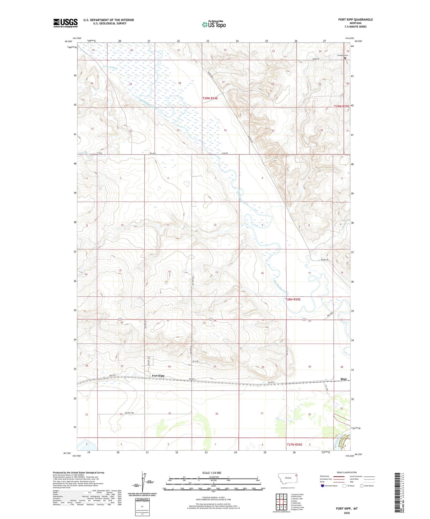
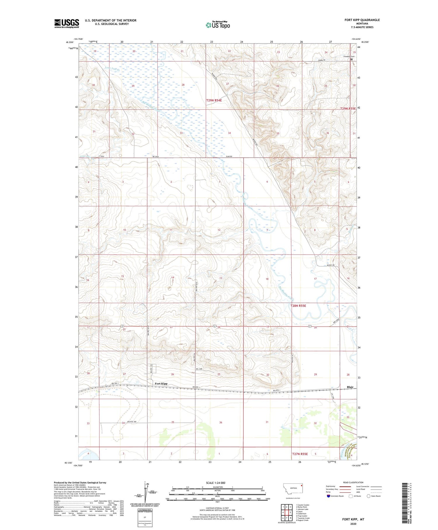
2020 topographic map quadrangle Fort Kipp in the state of Montana. Scale: 1:24000. Based on the newly updated USGS 7.5' US Topo map series, this map is in the following counties: Roosevelt, Richland. The map contains contour data, water features, and other items you are used to seeing on USGS maps, but also has updated roads and other features. This is the next generation of topographic maps. Printed on high-quality waterproof paper with UV fade-resistant inks.
Quads adjacent to this one:
West: Calais
Northwest: Coyote Coulee
North: Rocky Point
Northeast: Johnson Lake
East: Culbertson
Southeast: Dugout Creek
South: Twomile Creek
Southwest: Frog Coulee
Contains the following named places: 28N54E02DCCC01 Well, 28N54E03ADDA01 Well, 28N54E16DB__01 Well, 28N54E16DBBD01 Well, 28N54E21DC__01 Well, 28N54E23AD__01 Well, 28N54E25BC__01 Well, 28N54E25DB__01 Well, 28N54E26BD__01 Well, 28N54E26CB__01 Well, 28N54E26CB__02 Well, 28N54E26CD__01 Well, 28N54E26CD__02 Well, 28N54E26DB__01 Well, 28N54E26DB__02 Well, 28N54E26DD__01 Well, 28N54E27AD__01 Well, 28N54E27BC__01 Well, 28N54E27BC__02 Well, 28N54E27DC__01 Well, 28N54E33AD__01 Well, 28N54E33DD__01 Well, 28N54E35CA__01 Well, 28N54E35CAAB01 Well, 28N54E35DD__01 Well, 28N54E36BB__01 Well, 28N55E06ABAC01 Well, 28N55E28BB__01 Well, 28N55E28BBBB01 Well, 28N55E29BB__01 Well, 28N55E29DC__01 Well, 28N55E30DD__01 Well, 28N55E31AD__01 Well, 28N55E32AC__01 Well, 28N55E32BA__01 Well, Blair, Boyd, Boyd Post Office, Fort Kipp, Fort Kipp - Makaicu Presbyterian Church, Fort Kipp School, Freidens Cemetery, Freidens Church, Lone Tree Creek, Saint Anthony Station, Scott Creek