MyTopo
Johnson Lake Montana US Topo Map
Couldn't load pickup availability
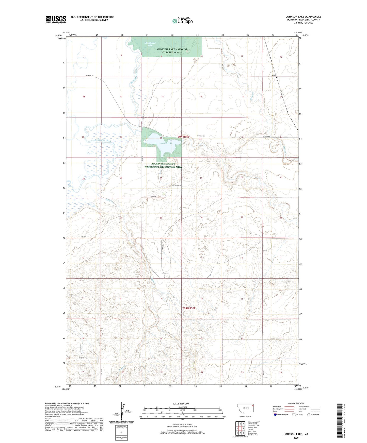
2024 topographic map quadrangle Johnson Lake in the state of Montana. Scale: 1:24000. Based on the newly updated USGS 7.5' US Topo map series, this map is in the following counties: Roosevelt. The map contains contour data, water features, and other items you are used to seeing on USGS maps, but also has updated roads and other features. This is the next generation of topographic maps. Printed on high-quality waterproof paper with UV fade-resistant inks.
Quads adjacent to this one:
West: Rocky Point
Northwest: Homestead NW
North: Homestead
Northeast: Medicine Lake
East: Froid
Southeast: McCabe West
South: Culbertson
Southwest: Fort Kipp
This map covers the same area as the classic USGS quad with code o48104c5.
Contains the following named places: 29N55E18DABC01 Well, 30N55E10DDDD01 Well, 30N55E16BBBA01 Well, 30N55E23DBAB01 Well, 30N55E32ACA_01 Well, 30N55E36DADD01 Well, 59226, Johnson Lake, Roosevelt County Waterfowl Production Area, Sand Creek, Sandy Butte School, Sheep Creek, Smith School