MyTopo
Dugout Creek Montana US Topo Map
Couldn't load pickup availability
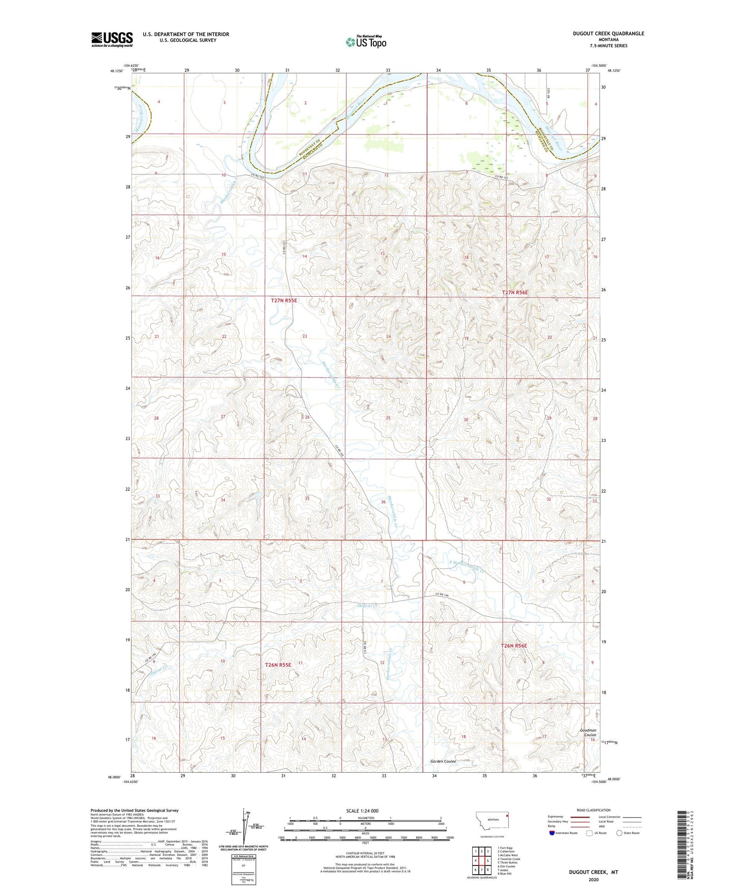
2024 topographic map quadrangle Dugout Creek in the state of Montana. Scale: 1:24000. Based on the newly updated USGS 7.5' US Topo map series, this map is in the following counties: Richland, Roosevelt. The map contains contour data, water features, and other items you are used to seeing on USGS maps, but also has updated roads and other features. This is the next generation of topographic maps. Printed on high-quality waterproof paper with UV fade-resistant inks.
Quads adjacent to this one:
West: Twomile Creek
Northwest: Fort Kipp
North: Culbertson
Northeast: McCabe West
East: Three Buttes
Southeast: Blue Hill
South: Andes
Southwest: Elm Coulee
This map covers the same area as the classic USGS quad with code o48104a5.
Contains the following named places: 27N55E03DB__01 Well, 27N55E03DB__02 Well, 27N55E09AD__01 Well, 27N55E10BB__01 Well, 27N55E10BB__02 Well, 27N55E10BC__01 Well, 27N55E11AA__01 Well, 27N55E12BB__01 Well, 27N55E12BC__01 Well, 27N55E12BD__01 Well, 27N55E15AC__01 Well, 27N55E15BB__01 Well, 27N55E15DC__01 Well, 27N55E21BA__01 Well, 27N55E21BA__02 Well, 27N55E22AABC01 Well, 27N55E23BB__01 Well, 27N55E23BB__02 Well, 27N55E23DBCA01 Well, 27N55E23DD__01 Well, 27N55E26BB__01 Well, 27N55E26BB__02 Well, 27N55E26BDAD01 Well, 27N55E26CA__01 Well, 27N55E26CA__02 Well, 27N55E26CA__03 Well, 27N56E05CA__01 Well, 27N56E06CC__01 Well, 27N56E06CC__02 Well, 27N56E07ACBC01 Well, 27N56E32CCBA01 Well, 59218, Corvette Dam, Dugout Creek, East Hardscrabble Creek, Garden Coulee, Hardscrabble Creek, Riverview School