MyTopo
Foster Montana US Topo Map
Couldn't load pickup availability
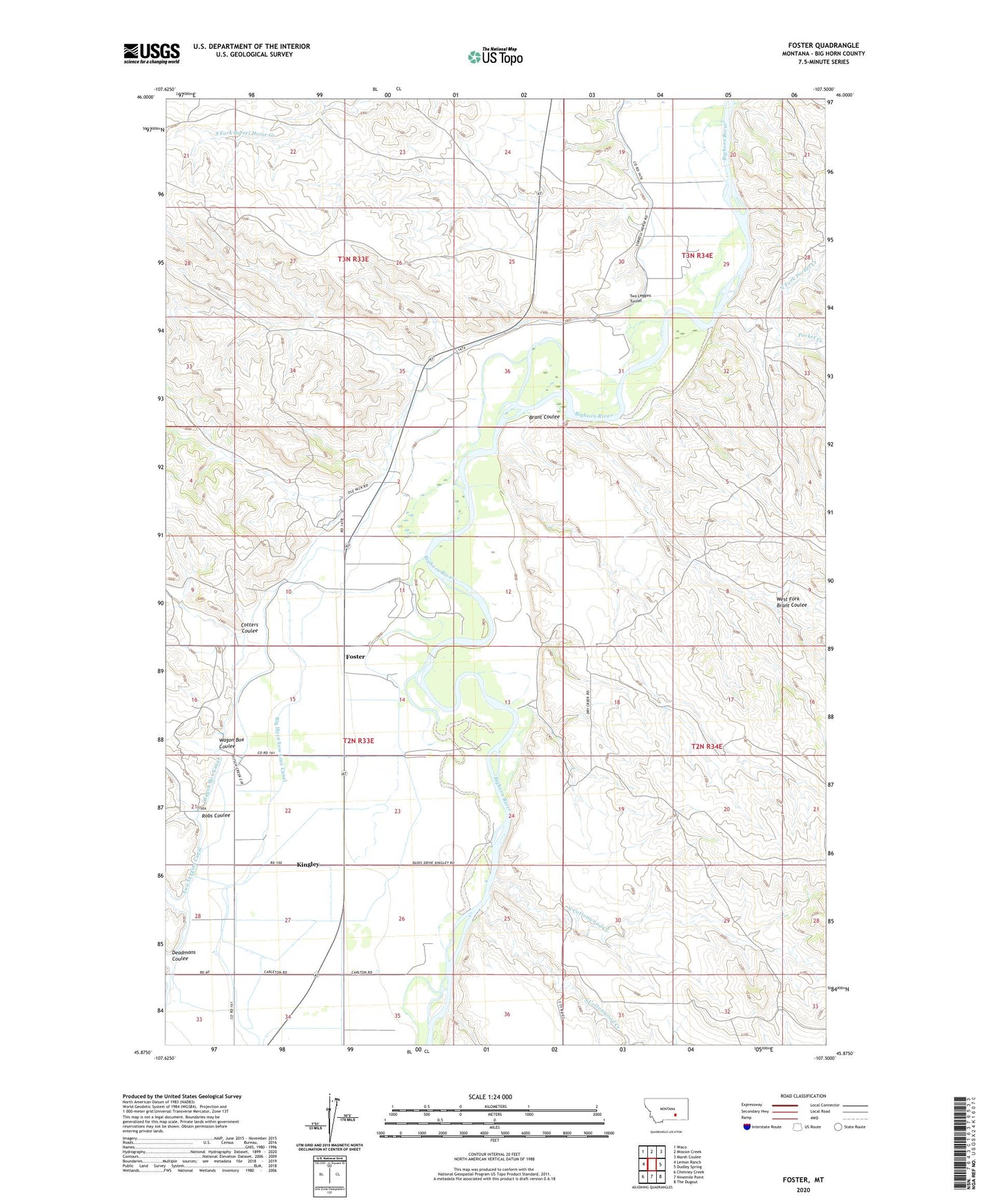
2020 topographic map quadrangle Foster in the state of Montana. Scale: 1:24000. Based on the newly updated USGS 7.5' US Topo map series, this map is in the following counties: Big Horn. The map contains contour data, water features, and other items you are used to seeing on USGS maps, but also has updated roads and other features. This is the next generation of topographic maps. Printed on high-quality waterproof paper with UV fade-resistant inks.
Quads adjacent to this one:
West: Lemon Ranch
Northwest: Waco
North: Mission Creek
Northeast: Marsh Coulee
East: Dudley Spring
Southeast: The Dugout
South: Ninemile Point
Southwest: Chimney Creek
Contains the following named places: 02N33E10DD__01 Well, 02N33E15BB__01 Well, 03N34E19CADC01 Well, Brant Coulee, Community School, Cotters Coulee, Deadmans Coulee, Fairview School, Foster, Foster Post Office, General Custer Fishing Access Site, Kingley, North Cottonwood Creek, North Fork Pocket Creek, North Fork Sorrel Horse Creek, Pocket Creek, Robs Coulee, Ryan, Sorrel Horse School, South Cottonwood Creek, South Fork Sorrel Horse Creek, Two Leggins Tunnel, Wagon Box Canal, Wagon Box Coulee, West Fork Brant Coulee