MyTopo
Marsh Coulee Montana US Topo Map
Couldn't load pickup availability
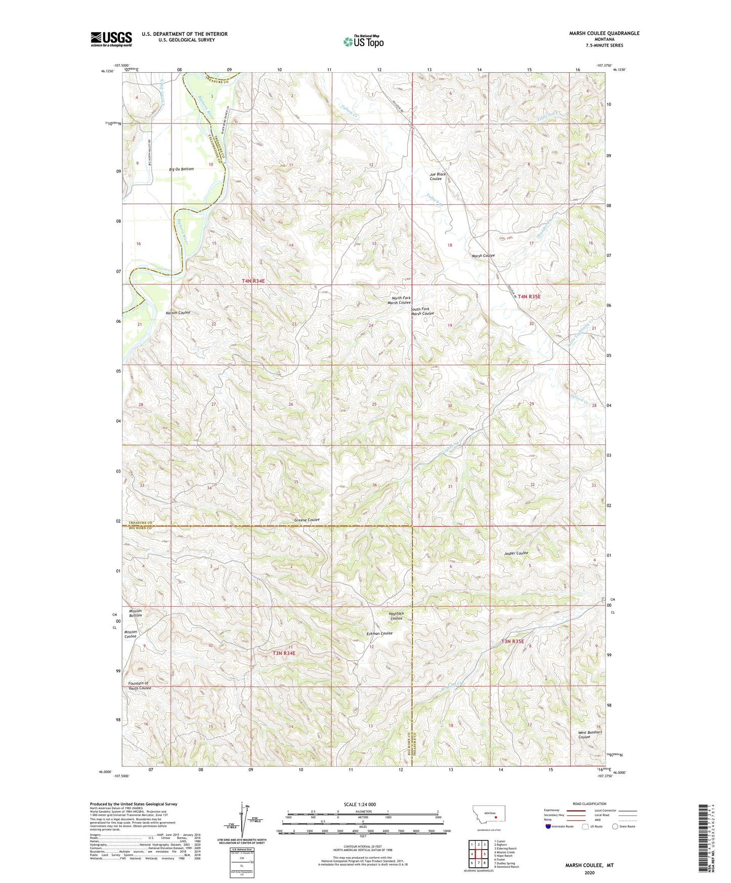
2024 topographic map quadrangle Marsh Coulee in the state of Montana. Scale: 1:24000. Based on the newly updated USGS 7.5' US Topo map series, this map is in the following counties: Treasure, Big Horn, Yellowstone. The map contains contour data, water features, and other items you are used to seeing on USGS maps, but also has updated roads and other features. This is the next generation of topographic maps. Printed on high-quality waterproof paper with UV fade-resistant inks.
Quads adjacent to this one:
West: Mission Creek
Northwest: Custer
North: Bighorn
Northeast: Eldering Ranch
East: Hope Ranch
Southeast: Hammond Ranch
South: Dudley Spring
Southwest: Foster
This map covers the same area as the classic USGS quad with code o46107a4.
Contains the following named places: Big Ox Bottom, Fountain of Youth Coulee, Joe Black Coulee, Little Joe Creek, Little Lightning Creek, Marsh Coulee, Mission Coulee, Nelson Coulee, North Fork Marsh Coulee, South Fork Marsh Coulee, Thunder Creek, Tullock Creek School, Victory Ditch, West Lightning Creek