MyTopo
Mission Creek Montana US Topo Map
Couldn't load pickup availability
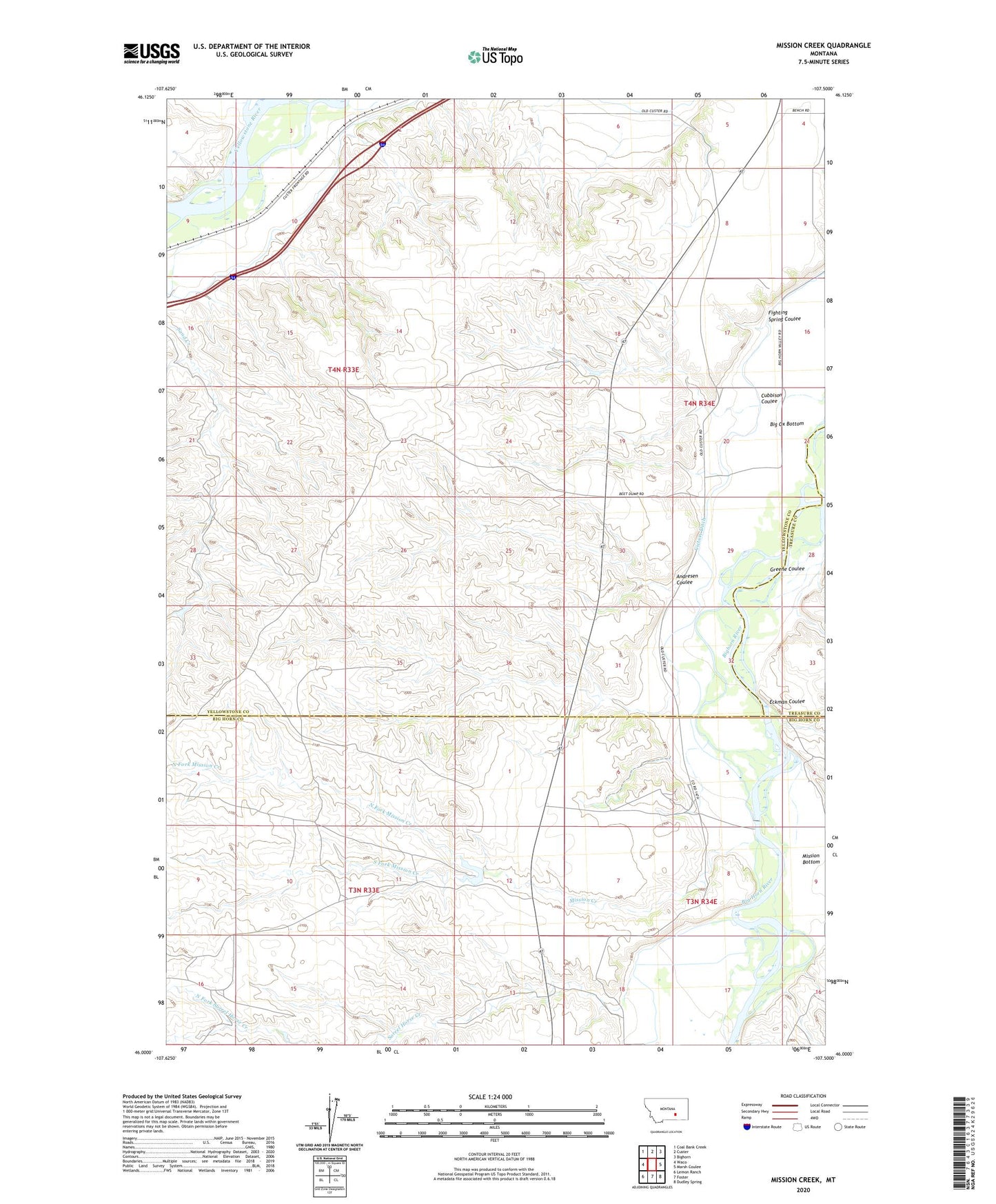
2024 topographic map quadrangle Mission Creek in the state of Montana. Scale: 1:24000. Based on the newly updated USGS 7.5' US Topo map series, this map is in the following counties: Yellowstone, Big Horn, Treasure. The map contains contour data, water features, and other items you are used to seeing on USGS maps, but also has updated roads and other features. This is the next generation of topographic maps. Printed on high-quality waterproof paper with UV fade-resistant inks.
Quads adjacent to this one:
West: Waco
Northwest: Coal Bank Creek
North: Custer
Northeast: Bighorn
East: Marsh Coulee
Southeast: Dudley Spring
South: Foster
Southwest: Lemon Ranch
This map covers the same area as the classic USGS quad with code o46107a5.
Contains the following named places: 03N34E08BADB01 Well, 03N34E18DC__01 Well, 03N34E18DC__02 Well, 04N34E17CDDB01 Well, Andresen Coulee, Cubbison Coulee, Eckman Coulee, Fighting Spring, Fighting Spring Coulee, Greene Coulee, Mission Bottom, Mission Creek, North Fork Mission Creek, Sand Creek, Sorrel Horse Creek, South Fork Mission Creek, Steele Ranch, Wolfe Ranch