MyTopo
Fourmile Creek Montana US Topo Map
Couldn't load pickup availability
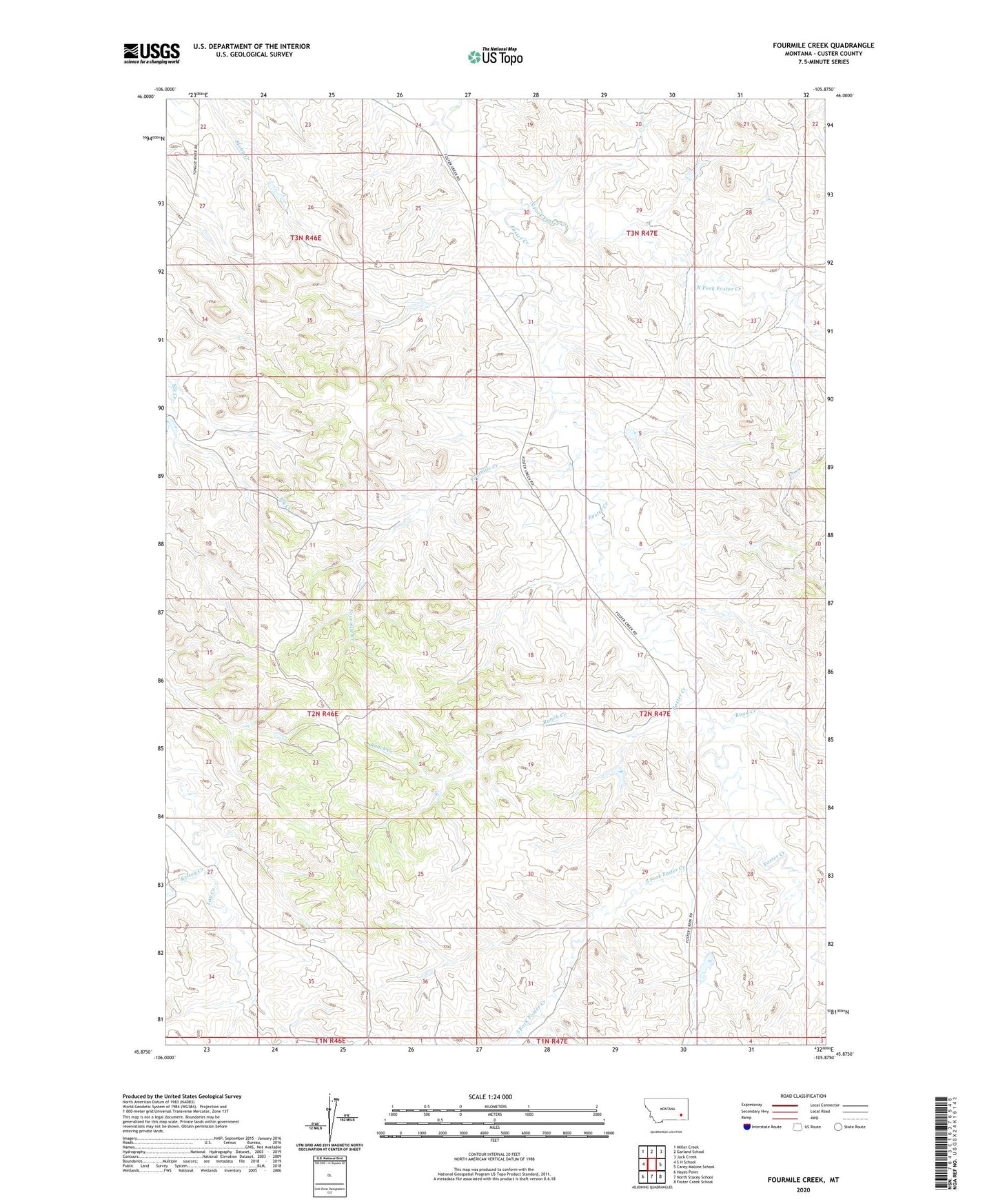
2024 topographic map quadrangle Fourmile Creek in the state of Montana. Scale: 1:24000. Based on the newly updated USGS 7.5' US Topo map series, this map is in the following counties: Custer. The map contains contour data, water features, and other items you are used to seeing on USGS maps, but also has updated roads and other features. This is the next generation of topographic maps. Printed on high-quality waterproof paper with UV fade-resistant inks.
Quads adjacent to this one:
West: S H School
Northwest: Miller Creek
North: Garland School
Northeast: Jack Creek
East: Carey-Malone School
Southeast: Foster Creek School
South: North Stacey School
Southwest: Hayes Point
This map covers the same area as the classic USGS quad with code o45105h8.
Contains the following named places: 02N46E23ABBC01 Well, 02N46E34BDAB01 Well, 02N47E32BBBC01 Well, 02N48E15BCBC01 Well, Fourmile Creek, Kelsey Creek, Nefsy Number 1 Dam, Nefsy Number 2 Dam, Nefsy Number 4 Dam, North Fork Foster Creek, Ranch Creek, Road Creek, South Fork Foster Creek