MyTopo
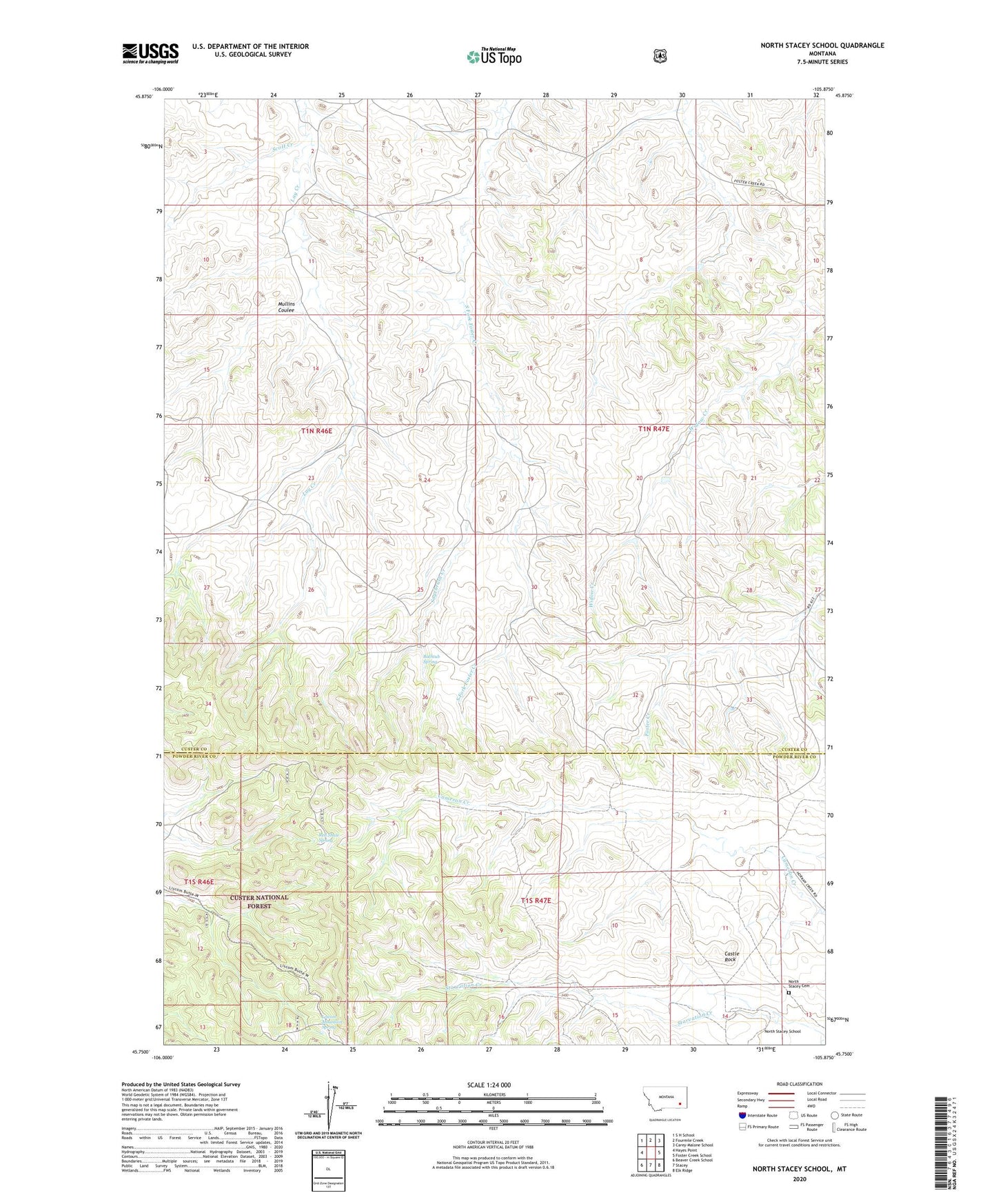
North Stacey School Montana US Topo Map
Couldn't load pickup availability
Also explore the North Stacey School Forest Service Topo of this same quad for updated USFS data
2024 topographic map quadrangle North Stacey School in the state of Montana. Scale: 1:24000. Based on the newly updated USGS 7.5' US Topo map series, this map is in the following counties: Custer, Powder River. The map contains contour data, water features, and other items you are used to seeing on USGS maps, but also has updated roads and other features. This is the next generation of topographic maps. Printed on high-quality waterproof paper with UV fade-resistant inks.
Quads adjacent to this one:
West: Hayes Point
Northwest: S H School
North: Fourmile Creek
Northeast: Carey-Malone School
East: Foster Creek School
Southeast: Elk Ridge
South: Stacey
Southwest: Beaver Creek School
This map covers the same area as the classic USGS quad with code o45105g8.
Contains the following named places: 01N46E03DBDD01 Well, 01N46E14DABD01 Well, 01N46E26ABCB01 Well, 01N47E04CCAA01 Well, 01N47E20AADC01 Well, 01N47E20ACDC01 Well, 01N47E28DDAD01 Well, 01N47E32ACDC01 Well, 01S47E11DDDD01 Well, 01S47E18BBDD01 Well, 01S55E17DAA_01 Well, Bathtub Spring, Castle Rock, Liscom Mountain Spring, Mullins Coulee, North Stacey Cemetery, North Stacey School, Red Shale Spring, Sagebrush Creek, Scott Creek