MyTopo
Miller Creek Montana US Topo Map
Couldn't load pickup availability
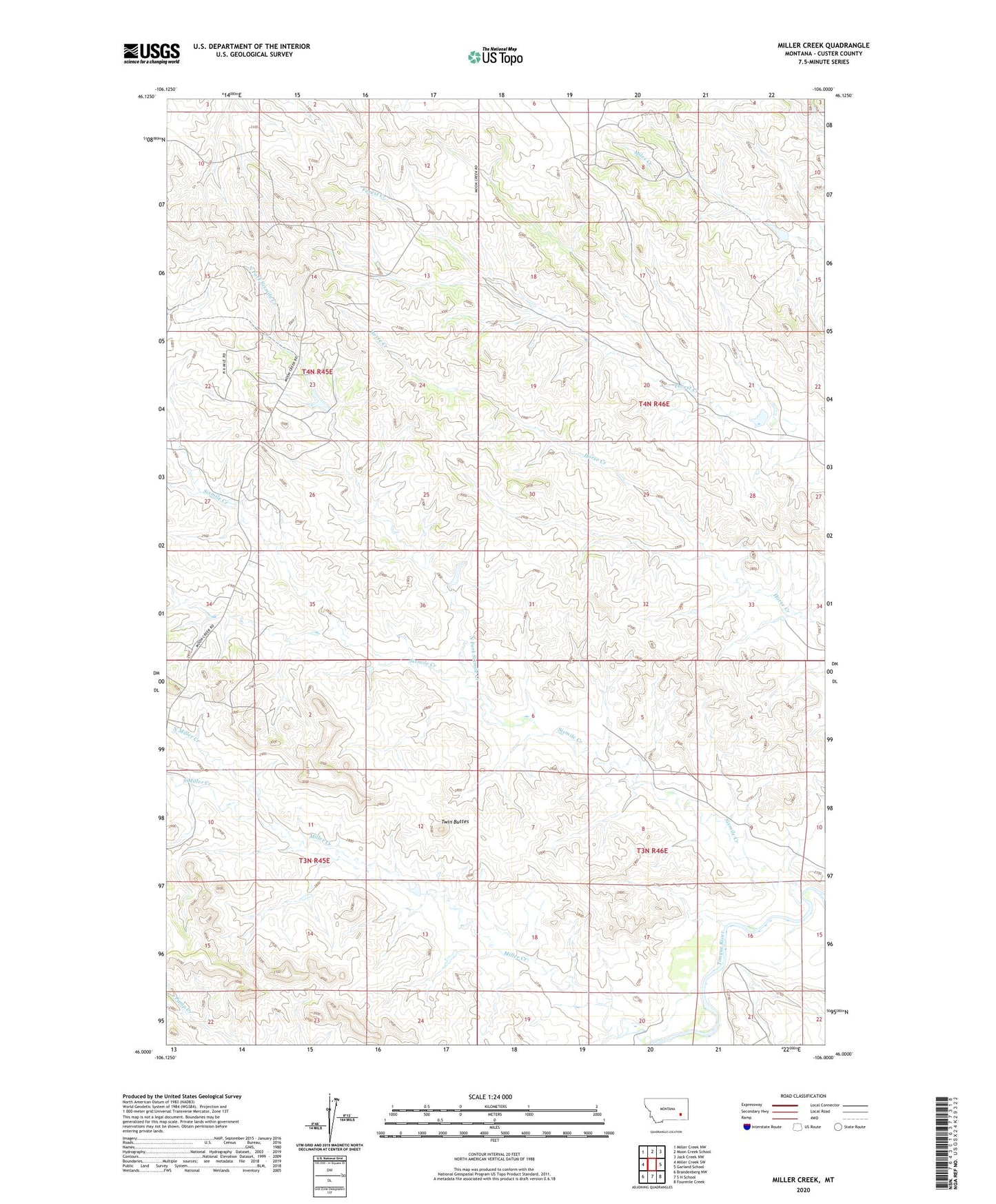
2024 topographic map quadrangle Miller Creek in the state of Montana. Scale: 1:24000. Based on the newly updated USGS 7.5' US Topo map series, this map is in the following counties: Custer. The map contains contour data, water features, and other items you are used to seeing on USGS maps, but also has updated roads and other features. This is the next generation of topographic maps. Printed on high-quality waterproof paper with UV fade-resistant inks.
Quads adjacent to this one:
West: Miller Creek SW
Northwest: Miller Creek NW
North: Moon Creek School
Northeast: Jack Creek NW
East: Garland School
Southeast: Fourmile Creek
South: S H School
Southwest: Brandenberg NW
This map covers the same area as the classic USGS quad with code o46106a1.
Contains the following named places: 03N45E13ABBC01 Well, 04N45E14ADCD01 Well, 04N45E26CCAC01 Well, Bumguartner Dam, Chezum Number 1 Dam, Elk Creek, Forest Creek Dam, Miller Creek, North Fork Sixmile Creek, North Miller Creek, Ronning Number 1 Dam, Sixmile Creek, South Miller Creek, Twin Buttes