MyTopo
Froid Montana US Topo Map
Couldn't load pickup availability
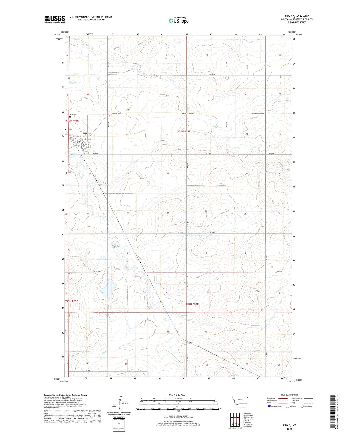
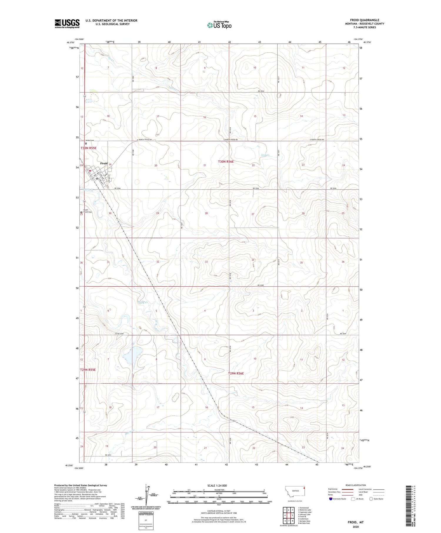
2020 topographic map quadrangle Froid in the state of Montana. Scale: 1:24000. Based on the newly updated USGS 7.5' US Topo map series, this map is in the following counties: Roosevelt. The map contains contour data, water features, and other items you are used to seeing on USGS maps, but also has updated roads and other features. This is the next generation of topographic maps. Printed on high-quality waterproof paper with UV fade-resistant inks.
Quads adjacent to this one:
West: Johnson Lake
Northwest: Homestead
North: Medicine Lake
Northeast: Capeneys Lake
East: Froid SE
Southeast: McCabe East
South: McCabe West
Southwest: Culbertson
Contains the following named places: 29N53E06BBBB01 Well, 29N56E02ADAB01 Well, 30N56E11BACD01 Well, Big Sky Church, Blowers School, Dahl Hospital, Dahley School, Faith Farm Church, Farmers Elevator Company of Froid - Elevator Number One, Fjeseth Field, Froid, Froid Elementary School, Froid Elevator Company of Froid - Elevator Number Two, Froid Lutheran Church, Froid Mission Chapel, Froid Post Office, Froid Public Library, Froid Volunteer Fire Department, Immaculate Conception Church, Kvile Cemetery, Leubke School, McCord School, Moen, Pioneer School, Rhoda School, South Froid Cemetery, Town of Froid, Town Park, Union Congregational Church, Zich School