
MyTopo
Garfield Peak Montana US Topo Map
Couldn't load pickup availability
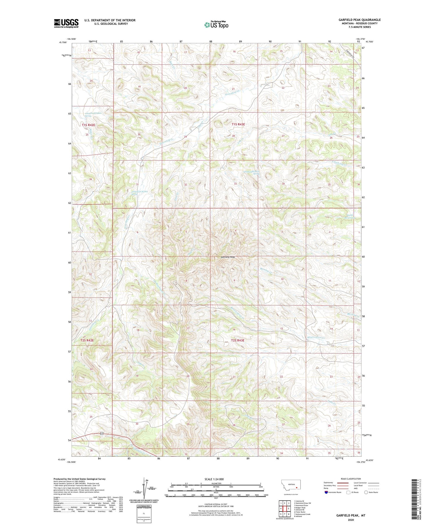
2020 topographic map quadrangle Garfield Peak in the state of Montana. Scale: 1:24000. Based on the newly updated USGS 7.5' US Topo map series, this map is in the following counties: Rosebud. The map contains contour data, water features, and other items you are used to seeing on USGS maps, but also has updated roads and other features. This is the next generation of topographic maps. Printed on high-quality waterproof paper with UV fade-resistant inks.
Quads adjacent to this one:
West: Badger Peak
Northwest: Colstrip SE
North: Hammond Draw SW
Northeast: Hammond Draw
East: Ashland NE
Southeast: Ashland
South: Hollowwood Creek
Southwest: Fisher Butte
Contains the following named places: 01S42E25BDAB01 Spring, 01S43E21CACD01 Well, 01S43E23BBBB01 Well, 01S43E27ADAD01 Well, 01S43E28DBAA01 Well, 01S43E29ACCC01 Well, 01S43E30DACA01 Well, 01S43E31CACD01 Spring, 01S43E32AABC01 Well, 01S43E33BDAA01 Well, 01S43E34BCBC01 Spring, 01S43E35AADB01 Well, 02S42E01BBAD01 Well, 02S42E01CACB01 Well, 02S43E02DBBD01 Well, 02S43E04ADDA01 Well, Ash Creek, Burning Coal Vein Area, Coal Creek, Fields Reservoir, Garfield Peak, Greenleaf School, Hollowbreast Creek, Wood Place


