
MyTopo
Gates Park Montana US Topo Map
Couldn't load pickup availability
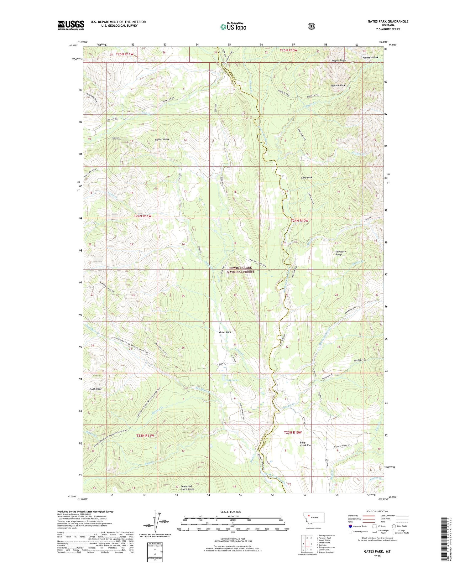
2020 topographic map quadrangle Gates Park in the state of Montana. Scale: 1:24000. Based on the newly updated USGS 7.5' US Topo map series, this map is in the following counties: Lewis and Clark, Teton. The map contains contour data, water features, and other items you are used to seeing on USGS maps, but also has updated roads and other features. This is the next generation of topographic maps. Printed on high-quality waterproof paper with UV fade-resistant inks.
Quads adjacent to this one:
West: Three Sisters
Northwest: Pentagon Mountain
North: Porphyry Reef
Northeast: Mount Wright
East: Our Lake
Southeast: Arsenic Mountain
South: Glenn Creek
Southwest: Slategoat Mountain
Contains the following named places: Biggs Creek Flat, Dryden Creek, Frazier Creek, Gates Creek, Gates Lake, Gates Park, Gates Park Guard Station, Headquarters Creek, Hoxsey Creek, Lick Creek, Lone Park, Lynx Creek, Miners Creek, Ninemile Park, Rabbit Butte, Ray Creek, Red Shale Creek, Rock Creek, Route Creek, South Fork Red Shale Creek, Spruce Creek, Sun River Game Preserve, Tenmile Park, Wrong Creek


