MyTopo
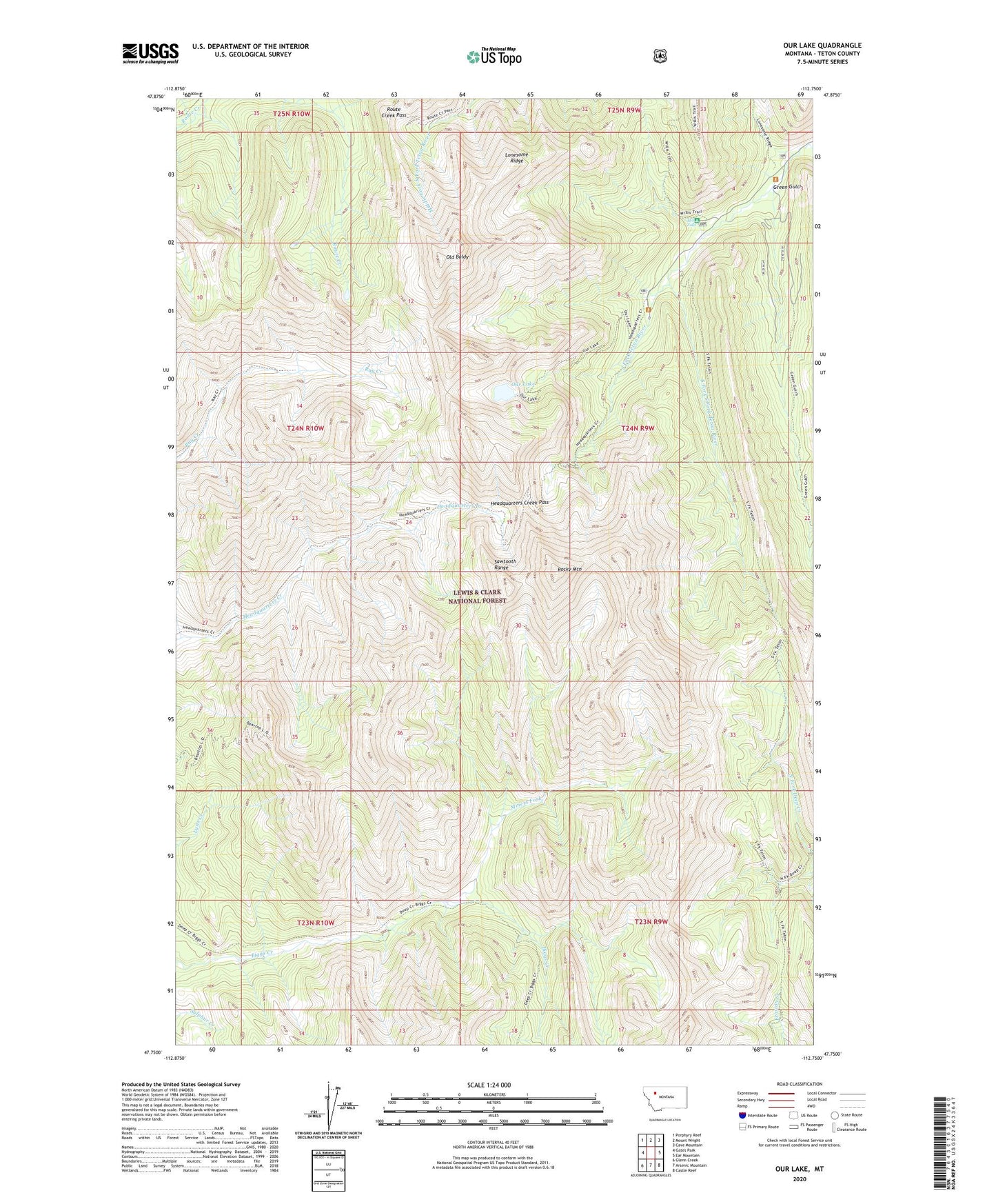
Our Lake Montana US Topo Map
Couldn't load pickup availability
Also explore the Our Lake Forest Service Topo of this same quad for updated USFS data
2024 topographic map quadrangle Our Lake in the state of Montana. Scale: 1:24000. Based on the newly updated USGS 7.5' US Topo map series, this map is in the following counties: Teton. The map contains contour data, water features, and other items you are used to seeing on USGS maps, but also has updated roads and other features. This is the next generation of topographic maps. Printed on high-quality waterproof paper with UV fade-resistant inks.
Quads adjacent to this one:
West: Gates Park
Northwest: Porphyry Reef
North: Mount Wright
Northeast: Cave Mountain
East: Ear Mountain
Southeast: Castle Reef
South: Arsenic Mountain
Southwest: Glenn Creek
This map covers the same area as the classic USGS quad with code o47112g7.
Contains the following named places: Beartop Lookout, Green Gulch, Headquarters Creek Pass, Lonesome Ridge, Mill Falls, Miners Fork, Old Baldy, Our Lake, Rocky Mountain, Rocky Mountain Hi Ski Area, Route Creek Pass, Scenic Waterfalls Campground, South Fork South Fork Teton River, South Fork Teton Trailhead