MyTopo
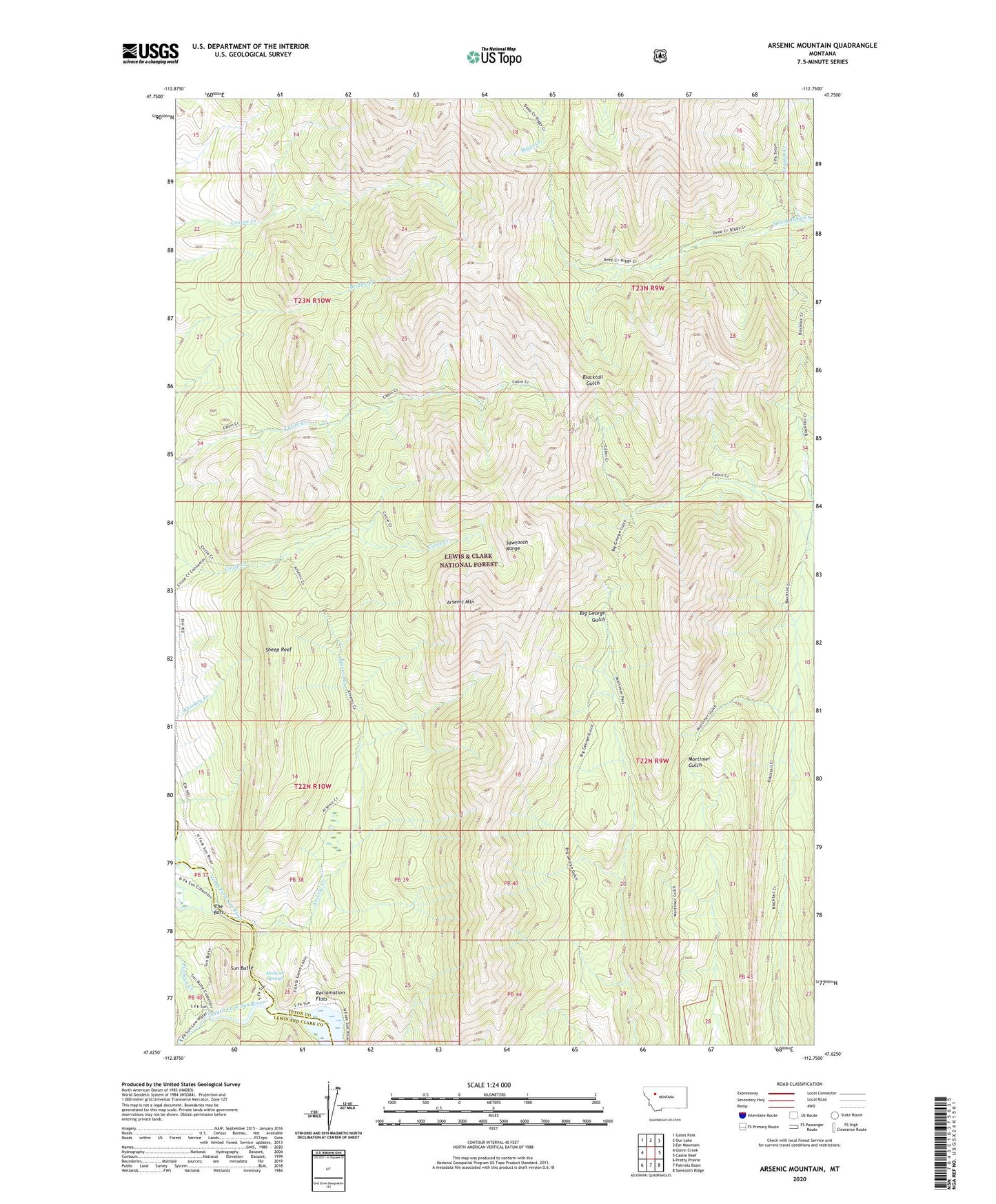
Arsenic Mountain Montana US Topo Map
Couldn't load pickup availability
Also explore the Arsenic Mountain Forest Service Topo of this same quad for updated USFS data
2024 topographic map quadrangle Arsenic Mountain in the state of Montana. Scale: 1:24000. Based on the newly updated USGS 7.5' US Topo map series, this map is in the following counties: Teton, Lewis and Clark. The map contains contour data, water features, and other items you are used to seeing on USGS maps, but also has updated roads and other features. This is the next generation of topographic maps. Printed on high-quality waterproof paper with UV fade-resistant inks.
Quads adjacent to this one:
West: Glenn Creek
Northwest: Gates Park
North: Our Lake
Northeast: Ear Mountain
East: Castle Reef
Southeast: Sawtooth Ridge
South: Patricks Basin
Southwest: Pretty Prairie
This map covers the same area as the classic USGS quad with code o47112f7.
Contains the following named places: Arsenic Creek, Arsenic Mountain, Furman Creek, JJJ Wilderness Ranch, K L Ranch, Klicks Resort, Medicine Springs, Mortimer Gulch National Recreation Trail, Reclamation Flats, Sheep Reef, Sorrell Guest Resort, South Fork Sun River, South Fork Teton-Blacktail National Recreation Trail, Sun Butte, The Bars, White Cabin