MyTopo
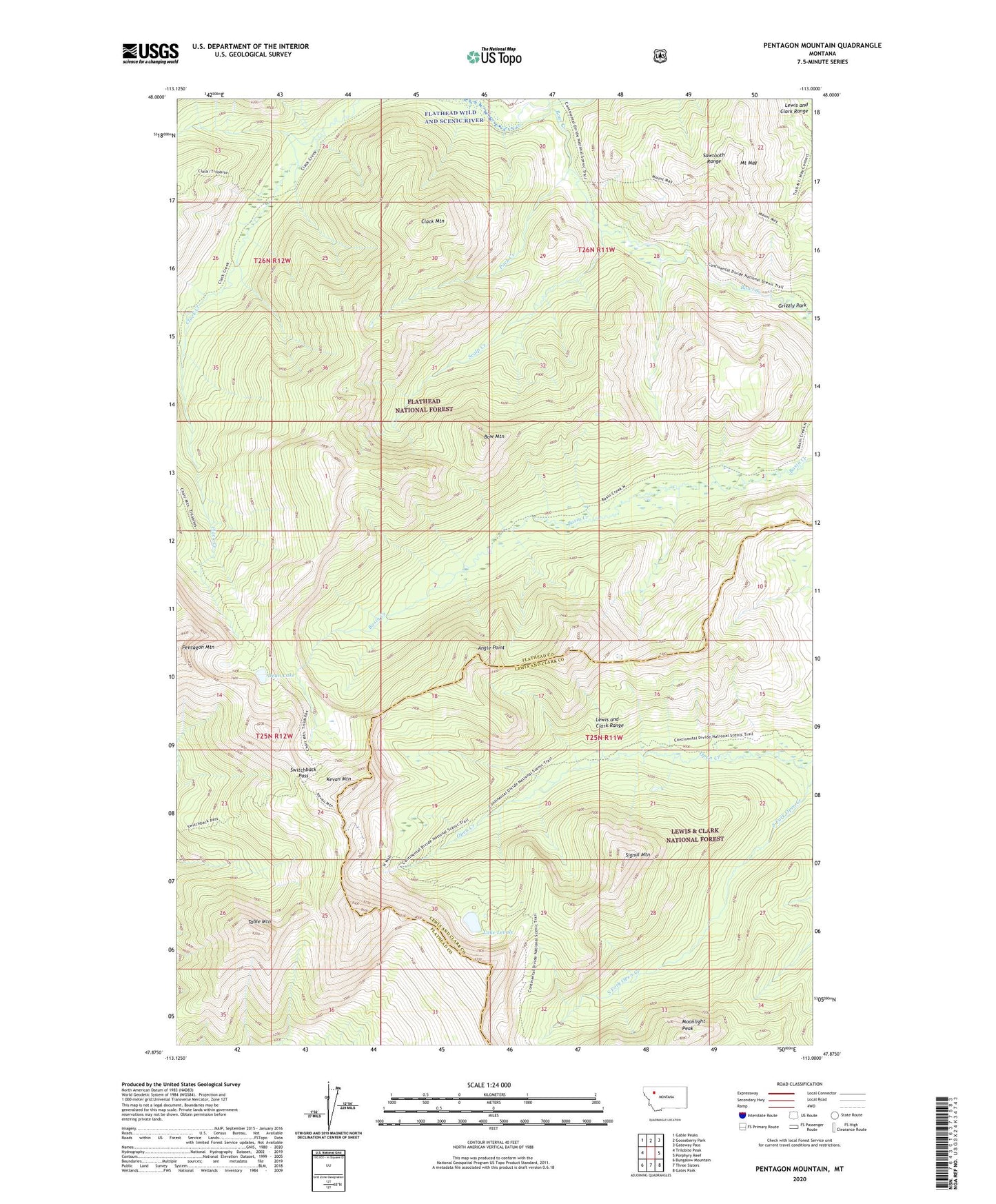
Pentagon Mountain Montana US Topo Map
Couldn't load pickup availability
Also explore the Pentagon Mountain Forest Service Topo of this same quad for updated USFS data
2024 topographic map quadrangle Pentagon Mountain in the state of Montana. Scale: 1:24000. Based on the newly updated USGS 7.5' US Topo map series, this map is in the following counties: Flathead, Lewis and Clark. The map contains contour data, water features, and other items you are used to seeing on USGS maps, but also has updated roads and other features. This is the next generation of topographic maps. Printed on high-quality waterproof paper with UV fade-resistant inks.
Quads adjacent to this one:
West: Trilobite Peak
Northwest: Gable Peaks
North: Gooseberry Park
Northeast: Gateway Pass
East: Porphyry Reef
Southeast: Gates Park
South: Three Sisters
Southwest: Bungalow Mountain
This map covers the same area as the classic USGS quad with code o47113h1.
Contains the following named places: Angle Point, Bow Mountain, Bowl Creek, Bowl Divide Trail, Clack Mountain, Dean Lake, Grizzly Park, Kevan Mountain, Lake Levale, Moonlight Peak, Mount May, Park Creek, Pentagon Mountain, Scalp Creek, Signal Mountain, Strawberry Creek, Switchback Pass, Table Mountain