MyTopo
Gildford Montana US Topo Map
Couldn't load pickup availability
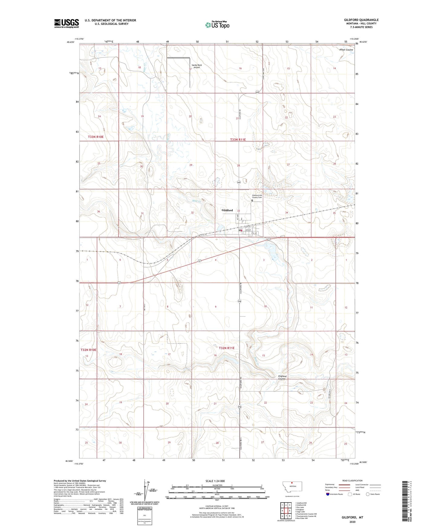
2024 topographic map quadrangle Gildford in the state of Montana. Scale: 1:24000. Based on the newly updated USGS 7.5' US Topo map series, this map is in the following counties: Hill. The map contains contour data, water features, and other items you are used to seeing on USGS maps, but also has updated roads and other features. This is the next generation of topographic maps. Printed on high-quality waterproof paper with UV fade-resistant inks.
Quads adjacent to this one:
West: Hingham
Northwest: Gildford NW
North: Gildford NE
Northeast: Dry Lake
East: Sage Lake
Southeast: Box Elder NW
South: Fourteenmile Coulee NE
Southwest: Fourteenmile Coulee NW
This map covers the same area as the classic USGS quad with code o48110e3.
Contains the following named places: England Coulee, General Mills Incorporated Elevator, Gildford, Gildford Census Designated Place, Gildford Hill County Cemetery, Gildford Pit, Gildford Post Office, Gildford Rural Fire Department, International Elevator, K-G High School, Saint Anthony and Dakota Elevator, Sandy Rock Airport