MyTopo
Gildford NW Montana US Topo Map
Couldn't load pickup availability
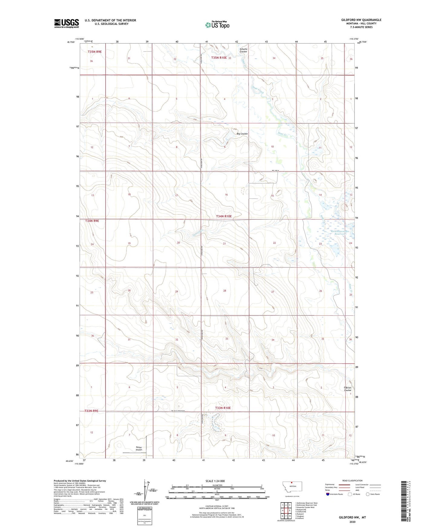
2024 topographic map quadrangle Gildford NW in the state of Montana. Scale: 1:24000. Based on the newly updated USGS 7.5' US Topo map series, this map is in the following counties: Hill. The map contains contour data, water features, and other items you are used to seeing on USGS maps, but also has updated roads and other features. This is the next generation of topographic maps. Printed on high-quality waterproof paper with UV fade-resistant inks.
Quads adjacent to this one:
West: Rudyard NE
Northwest: McKinnsey Reservoir West
North: McKinnsey Reservoir East
Northeast: Ninemile Coulee West
East: Gildford NE
Southeast: Gildford
South: Hingham
Southwest: Rudyard
This map covers the same area as the classic USGS quad with code o48110f4.
Contains the following named places: 33N10E07DACC01 Well, 34N10E14BCAA01 Well, 34N10E14BCAB01 Well, Big Coulee, Big Sage Hen Dam, Burkhartsmeyer Too Dam, Little Sage Creek, Mustapha Dam, O'Brien Coulee Dam, Pester Airport, Schultz Coulee, Tootsie Creek