MyTopo
Goose Lake Montana US Topo Map
Couldn't load pickup availability
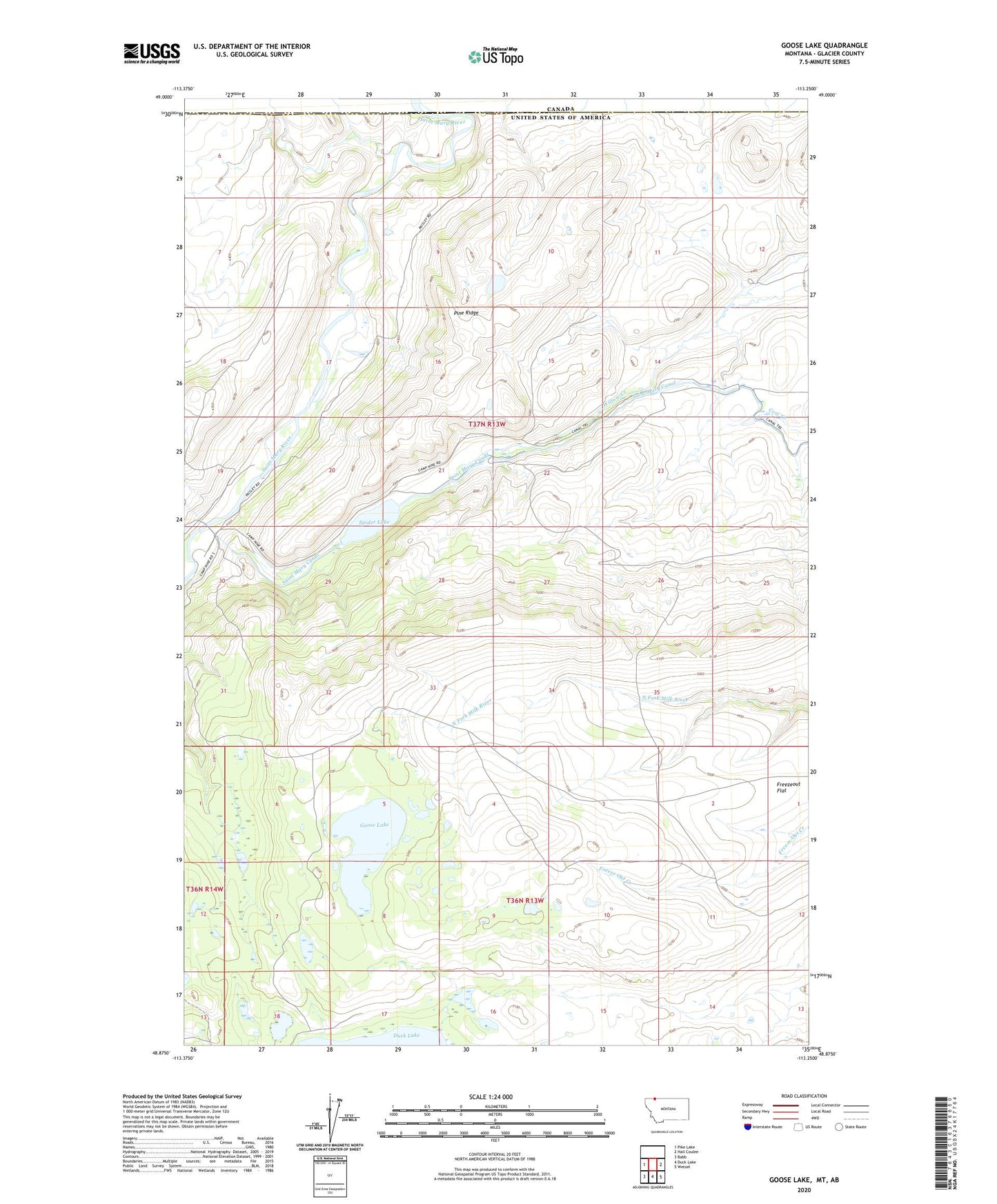
2024 topographic map quadrangle Goose Lake in the state of Montana. Scale: 1:24000. Based on the newly updated USGS 7.5' US Topo map series, this map is in the following counties: Glacier. The map contains contour data, water features, and other items you are used to seeing on USGS maps, but also has updated roads and other features. This is the next generation of topographic maps. Printed on high-quality waterproof paper with UV fade-resistant inks.
Quads adjacent to this one:
West: Pike Lake
East: Hall Coulee
Southeast: Wetzel
South: Duck Lake
Southwest: Babb
This map covers the same area as the classic USGS quad with code o48113h3.
Contains the following named places: Boundary Creek, Camp Nine, Fletcher Post Office, Freezeout Flat, Goose Lake, Pine Ridge, Saint Mary Canal, Spider Lake, Spider Lake Dam