MyTopo
Duck Lake Montana US Topo Map
Couldn't load pickup availability
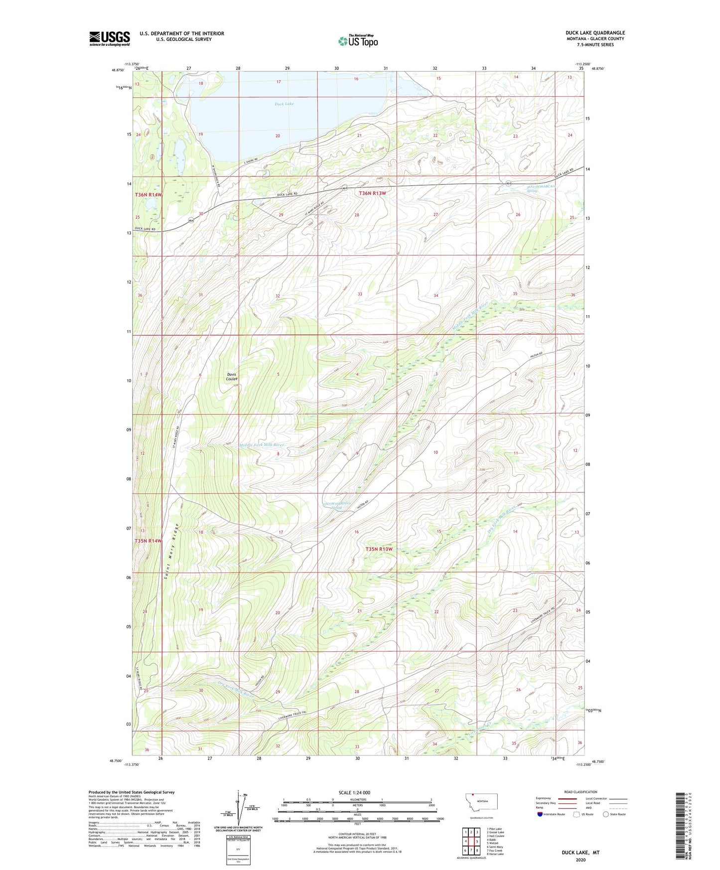
2024 topographic map quadrangle Duck Lake in the state of Montana. Scale: 1:24000. Based on the newly updated USGS 7.5' US Topo map series, this map is in the following counties: Glacier. The map contains contour data, water features, and other items you are used to seeing on USGS maps, but also has updated roads and other features. This is the next generation of topographic maps. Printed on high-quality waterproof paper with UV fade-resistant inks.
Quads adjacent to this one:
West: Babb
Northwest: Pike Lake
North: Goose Lake
Northeast: Hall Coulee
East: Wetzel
Southeast: Horse Lake
South: Fox Creek
Southwest: Saint Mary
This map covers the same area as the classic USGS quad with code o48113g3.
Contains the following named places: 35N13W16BBDD01 Spring, 36N13W20DACA01 Well, 36N13W20DBAD01 Well, 36N13W20DBDA01 Well, 36N13W26ABCA01 Spring, Duck Lake, Duck Lake Campground