MyTopo
Babb Montana US Topo Map
Couldn't load pickup availability
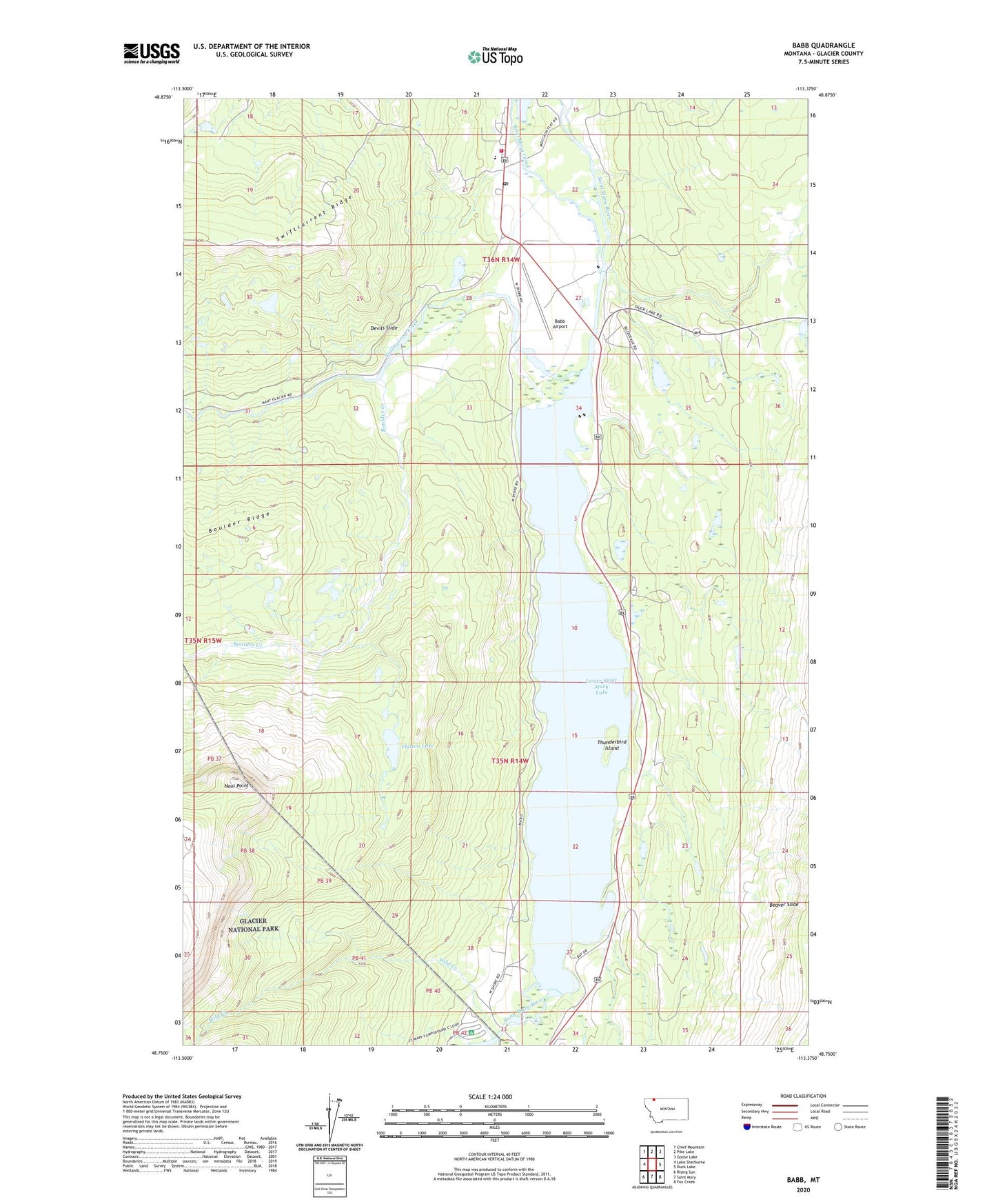
2024 topographic map quadrangle Babb in the state of Montana. Scale: 1:24000. Based on the newly updated USGS 7.5' US Topo map series, this map is in the following counties: Glacier. The map contains contour data, water features, and other items you are used to seeing on USGS maps, but also has updated roads and other features. This is the next generation of topographic maps. Printed on high-quality waterproof paper with UV fade-resistant inks.
Quads adjacent to this one:
West: Lake Sherburne
Northwest: Chief Mountain
North: Pike Lake
Northeast: Goose Lake
East: Duck Lake
Southeast: Fox Creek
South: Saint Mary
Southwest: Rising Sun
This map covers the same area as the classic USGS quad with code o48113g4.
Contains the following named places: Babb, Babb - Saint Mary Volunteer Fire Department, Babb Airport, Babb Post Office, Babb School, Beaver Slide, Boulder Creek, Chewing Blackbones Campground, Chief Mountain Baptist Church, Devils Slide, Divide Creek, Flatton Lake, Glacier County Emergency Medical Services Station 2, Leanin Tree Campground, Lower Saint Mary Lake, Main Post Office, Malmstrom Air Force Base Recreation Area, Naoi Point, Saint Mary Campground, Saint Mary Mission, Saint Mary Triple Divide Campground, Swiftcurrent Creek, Thunderbird Island, Two Sisters Campground, Wild Creek, ZIP Code: 59411