MyTopo
Griffin Coulee Montana US Topo Map
Couldn't load pickup availability
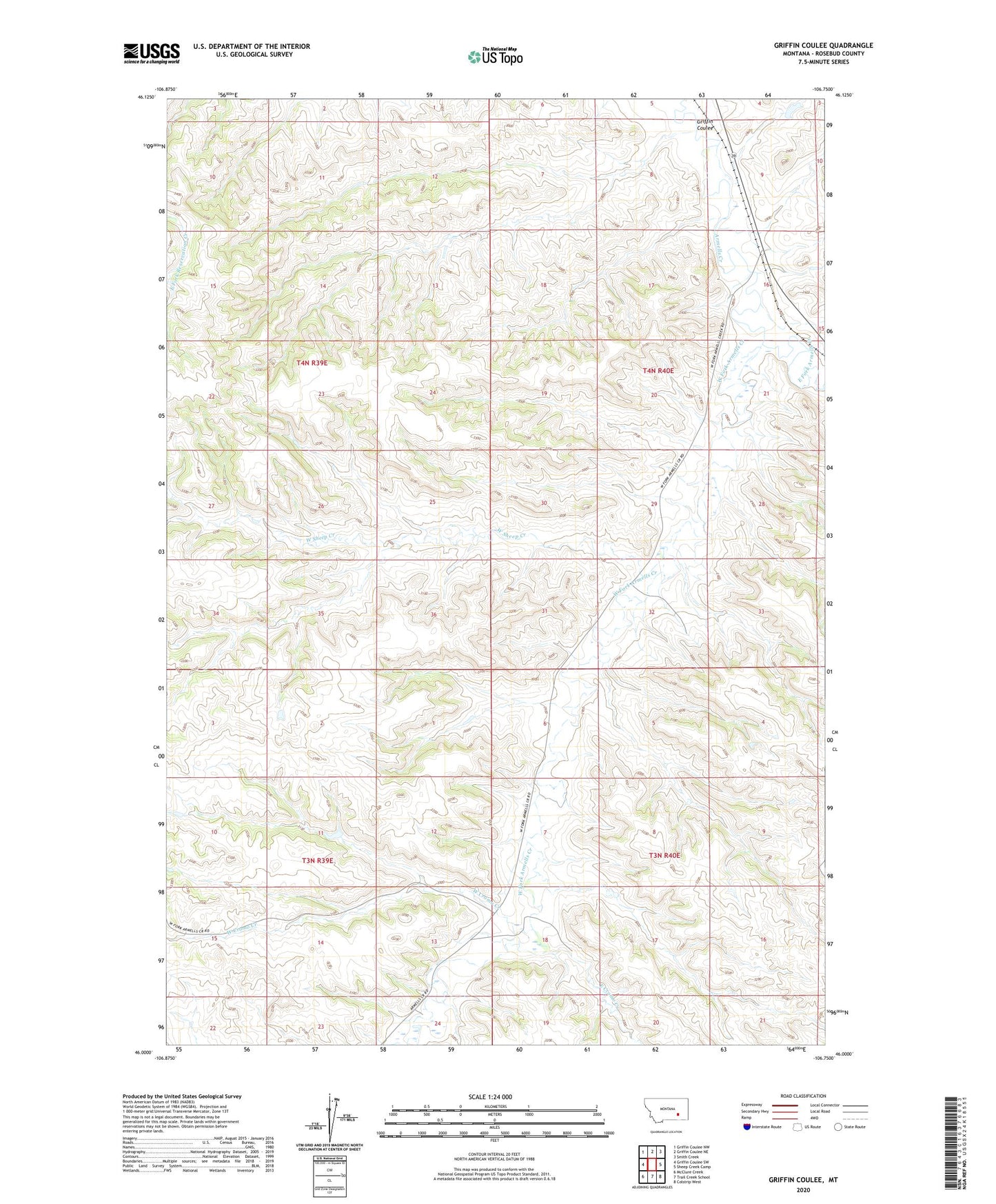
2024 topographic map quadrangle Griffin Coulee in the state of Montana. Scale: 1:24000. Based on the newly updated USGS 7.5' US Topo map series, this map is in the following counties: Rosebud. The map contains contour data, water features, and other items you are used to seeing on USGS maps, but also has updated roads and other features. This is the next generation of topographic maps. Printed on high-quality waterproof paper with UV fade-resistant inks.
Quads adjacent to this one:
West: Griffin Coulee SW
Northwest: Griffin Coulee NW
North: Griffin Coulee NE
Northeast: Smith Creek
East: Sheep Creek Camp
Southeast: Colstrip West
South: Trail Creek School
Southwest: McClure Creek
This map covers the same area as the classic USGS quad with code o46106a7.
Contains the following named places: 04N40E09ADDC01 Well, 04N40E21C___01 Well, 04N40E31DCAA01 Well, Ashenhurst Number 1 Dam, Dowlin, East Cromo Creek, East Fork Armells Creek, Gillin Ranch, Griffin Coulee, Lisle Post Office, West Cromo Creek, West Fork Armells Creek, West Sheep Creek