MyTopo
Smith Creek Montana US Topo Map
Couldn't load pickup availability
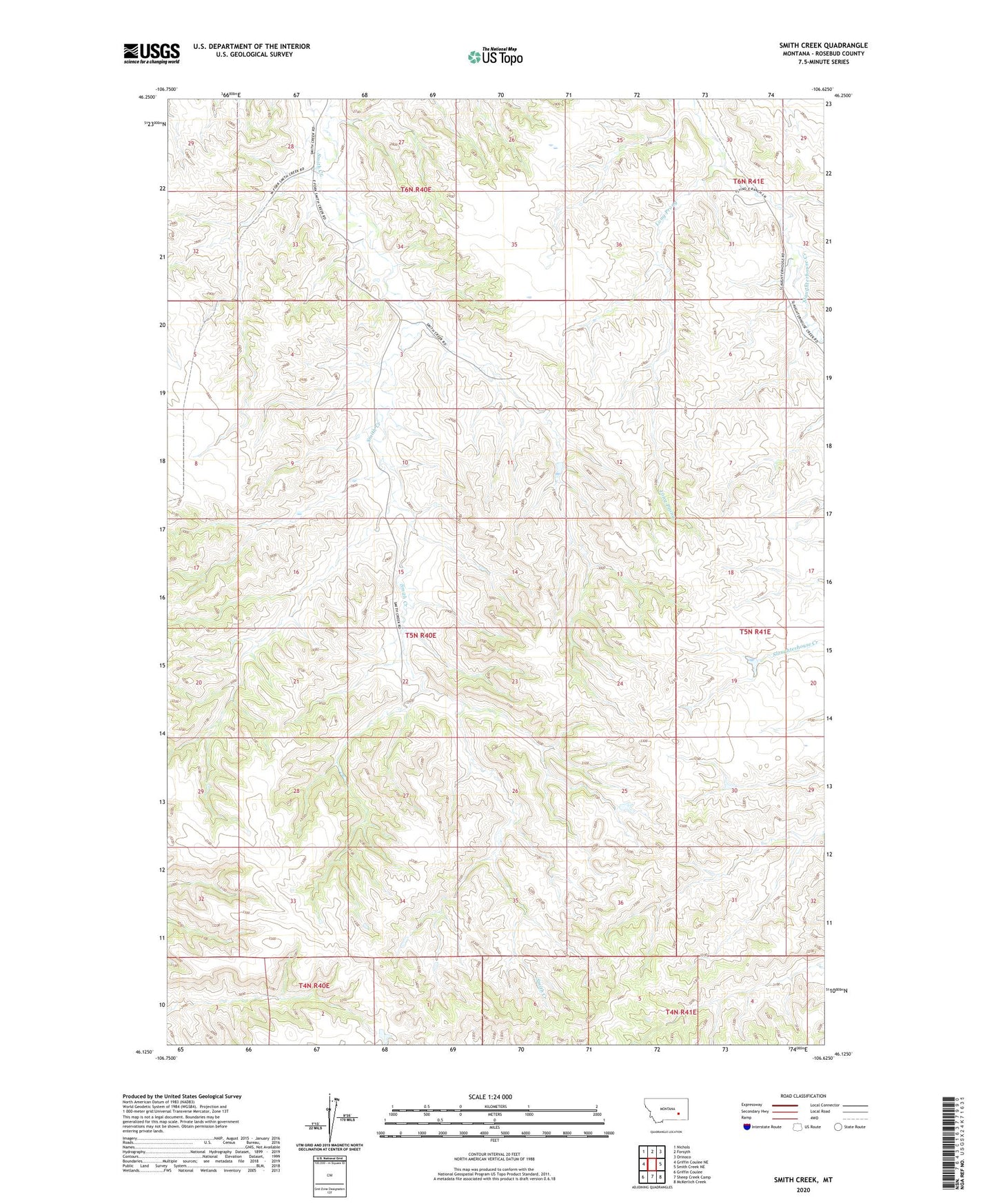
2024 topographic map quadrangle Smith Creek in the state of Montana. Scale: 1:24000. Based on the newly updated USGS 7.5' US Topo map series, this map is in the following counties: Rosebud. The map contains contour data, water features, and other items you are used to seeing on USGS maps, but also has updated roads and other features. This is the next generation of topographic maps. Printed on high-quality waterproof paper with UV fade-resistant inks.
Quads adjacent to this one:
West: Griffin Coulee NE
Northwest: Nichols
North: Forsyth
Northeast: Orinoco
East: Smith Creek NE
Southeast: McKerlich Creek
South: Sheep Creek Camp
Southwest: Griffin Coulee
This map covers the same area as the classic USGS quad with code o46106b6.
Contains the following named places: 05N40E22BDAC01 Well, 05N40E28AADC01 Well, 59327, Brock Camp, Forsyth Country Club, Friez Number 2 Dam, Long Prong, Pleasant Valley School, Rosebud County, Smith Creek School