MyTopo
Half Moon Hill Montana US Topo Map
Couldn't load pickup availability
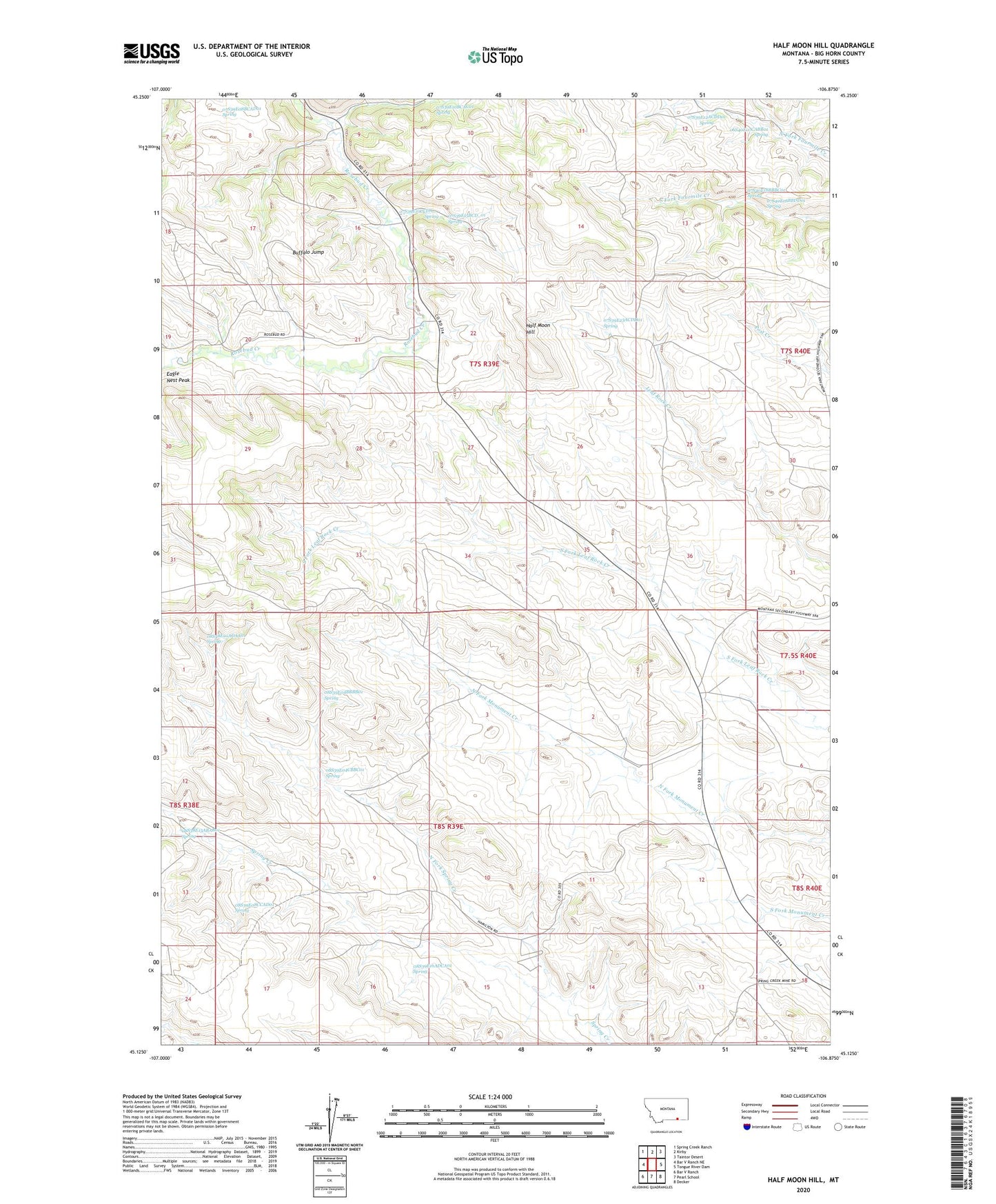
2020 topographic map quadrangle Half Moon Hill in the state of Montana. Scale: 1:24000. Based on the newly updated USGS 7.5' US Topo map series, this map is in the following counties: Big Horn. The map contains contour data, water features, and other items you are used to seeing on USGS maps, but also has updated roads and other features. This is the next generation of topographic maps. Printed on high-quality waterproof paper with UV fade-resistant inks.
Quads adjacent to this one:
West: Bar V Ranch NE
Northwest: Spring Creek Ranch
North: Kirby
Northeast: Taintor Desert
East: Tongue River Dam
Southeast: Decker
South: Pearl School
Southwest: Bar V Ranch
Contains the following named places: 06S40E07CABB01 Spring, 07S39E08BCAD01 Spring, 07S39E09CBA_01 Well, 07S39E09CBD_01 Well, 07S39E10BCAC01 Spring, 07S39E10CCDA__ Spring, 07S39E11DDB_01 Well, 07S39E12ACDD01 Spring, 07S39E14AAD_01 Well, 07S39E15BCD_01 Spring, 07S39E15DBA_01 Well, 07S39E16ACD_01 Well, 07S39E16ADAD01 Well, 07S39E16ADC_01 Well, 07S39E20DAAC01 Well, 07S39E20DADA01 Well, 07S39E21ADA_01 Well, 07S39E21ADA_02 Well, 07S39E21CDA_01 Well, 07S39E21CDA_02 Well, 07S39E22BCDC01 Well, 07S39E23ACD_02 Well, 07S39E23ACD_03 Well, 07S39E23ACD_04 Well, 07S39E23ACD_05 Well, 07S39E23ACD_06 Well, 07S39E23ACD_07 Well, 07S39E23ACDD01 Spring, 07S39E24BCD_01 Well, 07S39E24DDD_01 Well, 07S39E27CDC_01 Well, 07S39E27DCDD01 Well, 07S39E31ACA_01 Well, 07S39E34BCCB01 Well, 07S39E35ACC_01 Well, 07S39E35DAB_01 Well, 07S39E36CDD_01 Well, 07S40E18BBBC01 Spring, 07S40E18BBDD01 Spring, 07S40E30CCBD01 Well, 07S40E30DABB01 Well, 08S38E01ADAA01 Spring, 08S38E12DCDD01 Well, 08S38E13ABAB01 Spring, 08S39E01ABAA01 Well, 08S39E01BABB01 Well, 08S39E01DCCC01 Well, 08S39E02DAAD01 Well, 08S39E02DAAD02 Well, 08S39E04BBBB01 Spring, 08S39E04CBBC01 Spring, 08S39E08CCAD01 Spring, 08S39E12ACBB01 Well, 08S39E12ACBB02 Well, 08S39E13BBCC01 Well, 08S39E14CBBC01 Well, 08S39E16ADCA01 Spring, 08S40E07BBCA01 Well, 08S40E18BBAD01 Well, Big Bend School, Bluffer Post Office, Buffalo Jump, Eagle Nest Peak, Half Moon Hill, Monument Hill, North Fork Spring Creek, Rosebud Battlefield State Park