MyTopo
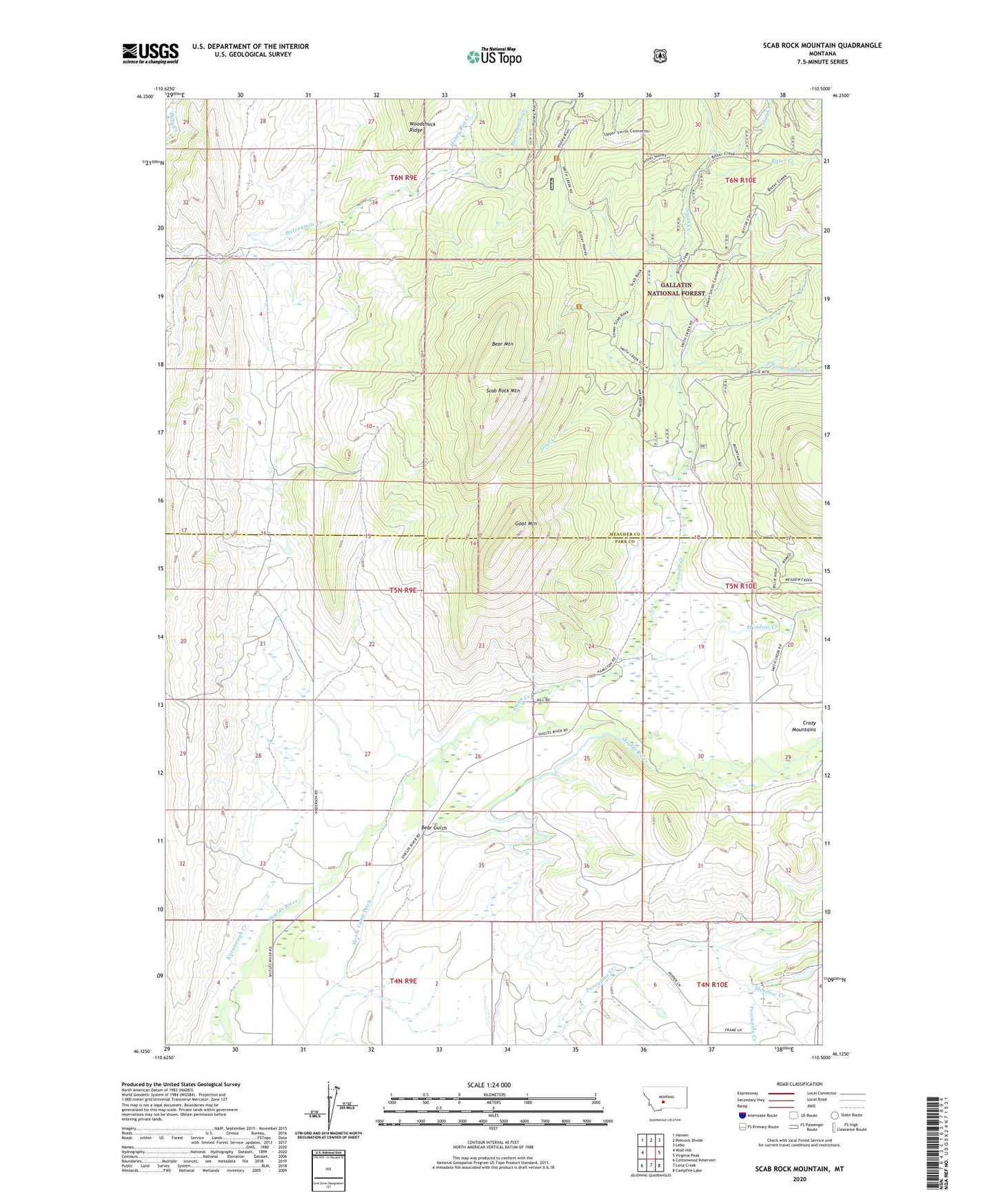
Scab Rock Mountain Montana US Topo Map
Couldn't load pickup availability
Also explore the Scab Rock Mountain Forest Service Topo of this same quad for updated USFS data
2024 topographic map quadrangle Scab Rock Mountain in the state of Montana. Scale: 1:24000. Based on the newly updated USGS 7.5' US Topo map series, this map is in the following counties: Park, Meagher. The map contains contour data, water features, and other items you are used to seeing on USGS maps, but also has updated roads and other features. This is the next generation of topographic maps. Printed on high-quality waterproof paper with UV fade-resistant inks.
Quads adjacent to this one:
West: Wolf Hill
Northwest: Hamen
North: Rimrock Divide
Northeast: Lebo
East: Virginia Peak
Southeast: Campfire Lake
South: Lena Creek
Southwest: Cottonwood Reservoir
This map covers the same area as the classic USGS quad with code o46110b5.
Contains the following named places: 04N09E03B___01 Well, 04N10E06AD__01 Well, 04N10E06B___01 Well, Anderson Dam, Bear Gulch, Bear Mountain, Bitter Creek, East Fork Smith Creek, Goat Creek, Goat Mountain, Honey Run Creek, Horse Camp Ditch, Kavanaugh Creek, Lat Post Office, Lat School, Meadow Creek, Middle Fork Porcupine Creek, Pepper Dam, Scab Rock Mountain, Smith Creek, Stag Creek, Westling Dam