
MyTopo
Hammond Draw Montana US Topo Map
Couldn't load pickup availability
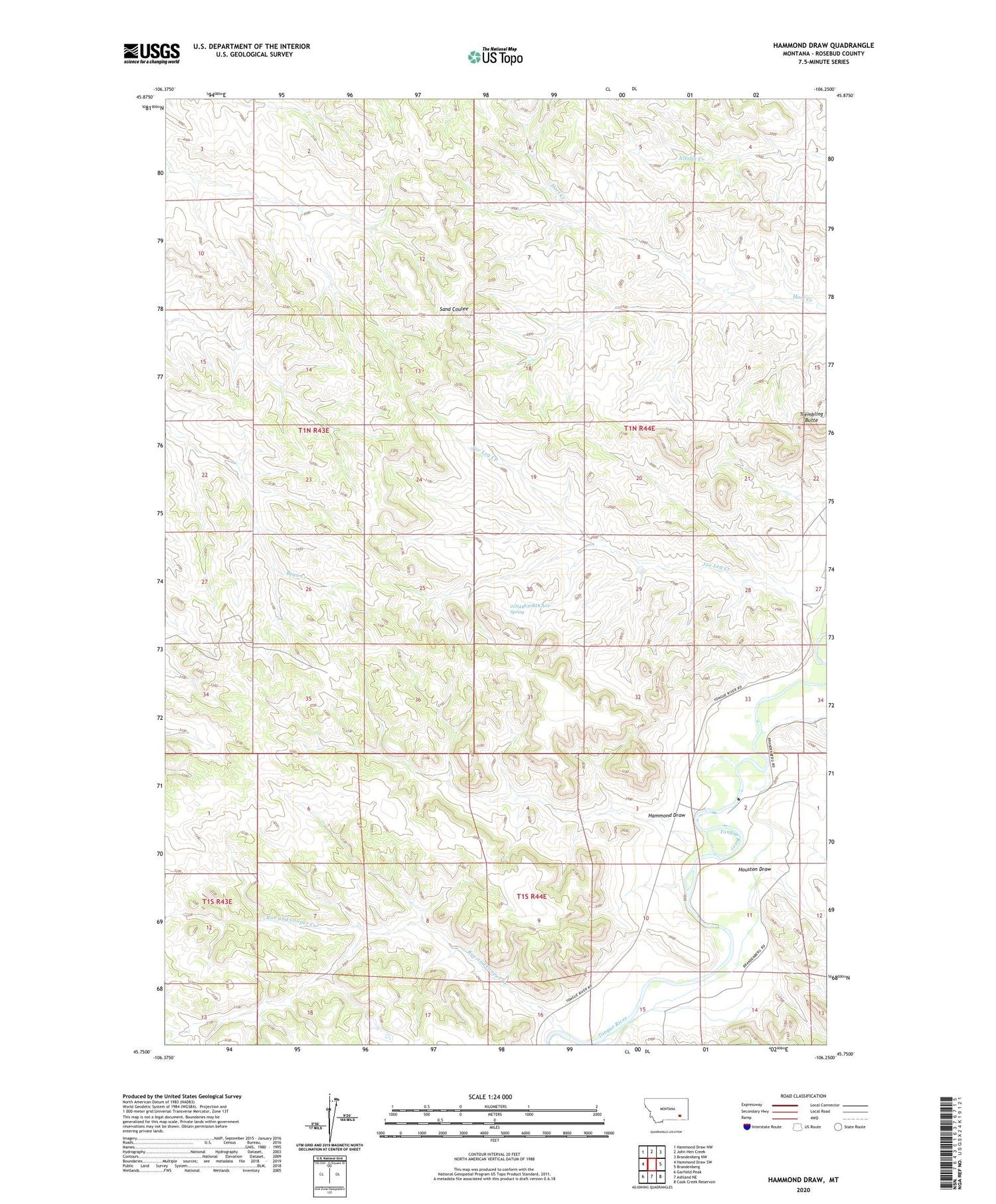
2020 topographic map quadrangle Hammond Draw in the state of Montana. Scale: 1:24000. Based on the newly updated USGS 7.5' US Topo map series, this map is in the following counties: Rosebud. The map contains contour data, water features, and other items you are used to seeing on USGS maps, but also has updated roads and other features. This is the next generation of topographic maps. Printed on high-quality waterproof paper with UV fade-resistant inks.
Quads adjacent to this one:
West: Hammond Draw SW
Northwest: Hammond Draw NW
North: John Hen Creek
Northeast: Brandenberg NW
East: Brandenberg
Southeast: Cook Creek Reservoir
South: Ashland NE
Southwest: Garfield Peak
Contains the following named places: 01N43E02CCDA01 Well, 01N43E15ACAA01 Well, 01N43E22BBAA01 Well, 01N43E24DDAA01 Well, 01N43E25BBDC01 Well, 01N43E26BCAB01 Well, 01N43E27CDDD01 Well, 01N43E36BDAC01 Well, 01N44E04DABD01 Well, 01N44E06CDAB01 Well, 01N44E07AADA01 Well, 01N44E08ACCB01 Well, 01N44E16DBDB01 Well, 01N44E17AAAD01 Well, 01N44E18AACB01 Well, 01N44E19DCAA01 Well, 01N44E27CBAC01 Well, 01N44E29ACBD01 Well, 01N44E30BCDA01 Well, 01N44E30BDCA01 Spring, 01N44E31AABA01 Well, 01N44E31CDCB01 Well, 01N44E33DBDC01 Well, 01S44E04DBAA01 Well, 01S44E05ABCC01 Well, 01S44E06CAAB01 Well, 01S44E08DCAD01 Well, 01S44E10CDBC01 Well, 01S44E14B___01 Well, Brandenburg School, Geddes Post Office, Hammond Draw, Houston Draw, Roe and Cooper Creek, Trembling Butte


