MyTopo
Hauck Coulee Montana US Topo Map
Couldn't load pickup availability
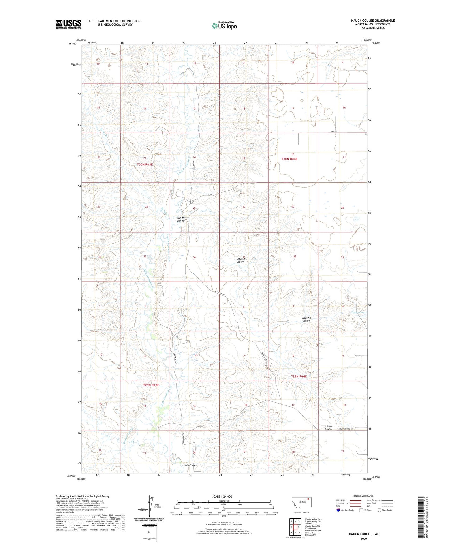
2024 topographic map quadrangle Hauck Coulee in the state of Montana. Scale: 1:24000. Based on the newly updated USGS 7.5' US Topo map series, this map is in the following counties: Valley. The map contains contour data, water features, and other items you are used to seeing on USGS maps, but also has updated roads and other features. This is the next generation of topographic maps. Printed on high-quality waterproof paper with UV fade-resistant inks.
Quads adjacent to this one:
West: Spring Creek SW
Northwest: Spring Valley West
North: Spring Valley East
Northeast: Lustre
East: Todd Lakes
Southeast: Oswego NW
South: Dubbe Reservoir
Southwest: Milk River Coulee
This map covers the same area as the classic USGS quad with code o48106c1.
Contains the following named places: 29N44E09ACDC01 Well, 29N44E09ACDD01 Well, 29N44E16DDDC01 Well, 30N44E07DDD_01 Well, 30N44E09CBAB01 Well, 30N44E20ACBA01 Well, 30N44E28DCDB01 Well, Hauck Coulee, Jack Norris Coulee, Neufeld Coulee, O'Watch Coulee, Pleasant Valley School, Spring Creek, Star School, Tomato Can Creek