MyTopo
Todd Lakes Montana US Topo Map
Couldn't load pickup availability
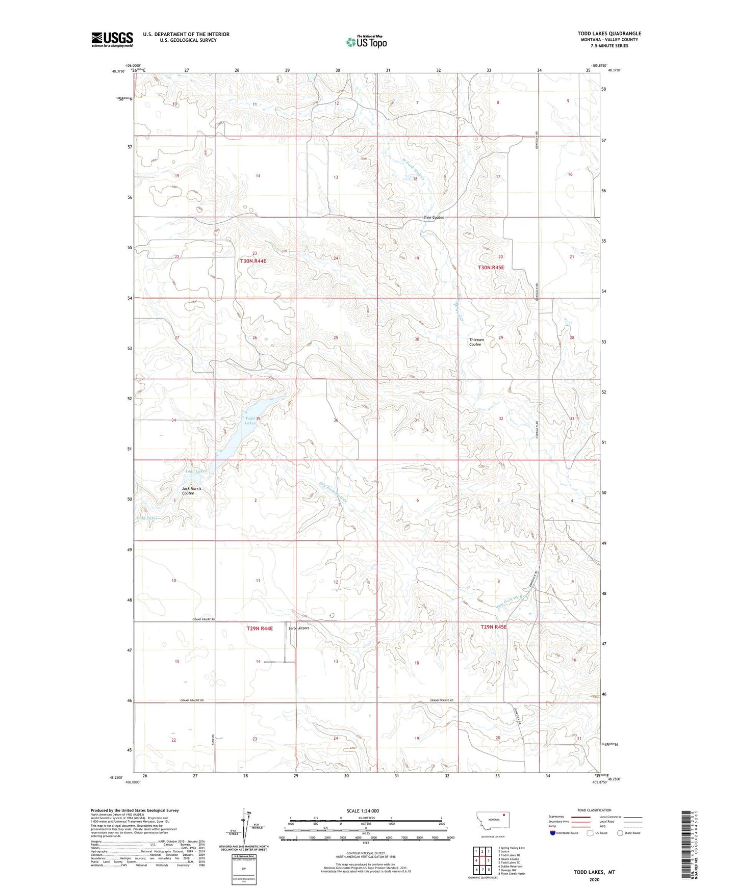
2024 topographic map quadrangle Todd Lakes in the state of Montana. Scale: 1:24000. Based on the newly updated USGS 7.5' US Topo map series, this map is in the following counties: Valley. The map contains contour data, water features, and other items you are used to seeing on USGS maps, but also has updated roads and other features. This is the next generation of topographic maps. Printed on high-quality waterproof paper with UV fade-resistant inks.
Quads adjacent to this one:
West: Hauck Coulee
Northwest: Spring Valley East
North: Lustre
Northeast: Todd Lakes NE
East: Todd Lakes SE
Southeast: Flynn Creek North
South: Oswego NW
Southwest: Dubbe Reservoir
This map covers the same area as the classic USGS quad with code o48105c8.
Contains the following named places: 29N44E03BBCA01 Well, 29N44E03BBCD01 Well, 29N44E14ADAB01 Well, 29N44E23BCCA01 Well, 29N44E23BCCD01 Well, 29N44E24ABBA01 Well, 29N45E18CCBB01 Well, 30N44E11CCAB01 Well, 30N44E22BCBC01 Well, 30N45E16ACBD01 Well, 30N45E17AABB01 Well, 30N45E28BBDA02 Well, 30N45E28BBDB01 Well, 59225, Baker School, Bakers, Cavens Church, Grand Prairie School, Koslowski School, Oswego District, South Fork School, Thiessen Coulee, Todd Lake Dam, Todd Lakes, Tree Coulee, Wolf Creek School, Zerbe Airport