MyTopo
Hawley Hill Montana US Topo Map
Couldn't load pickup availability
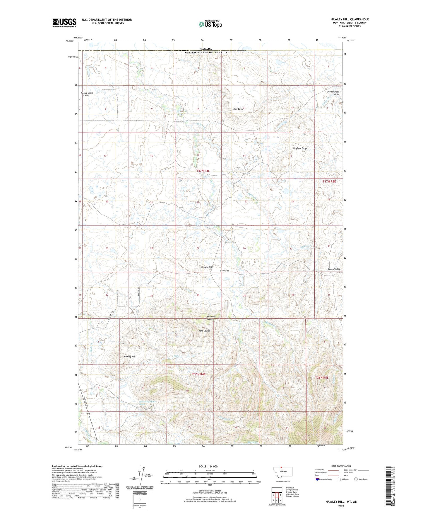
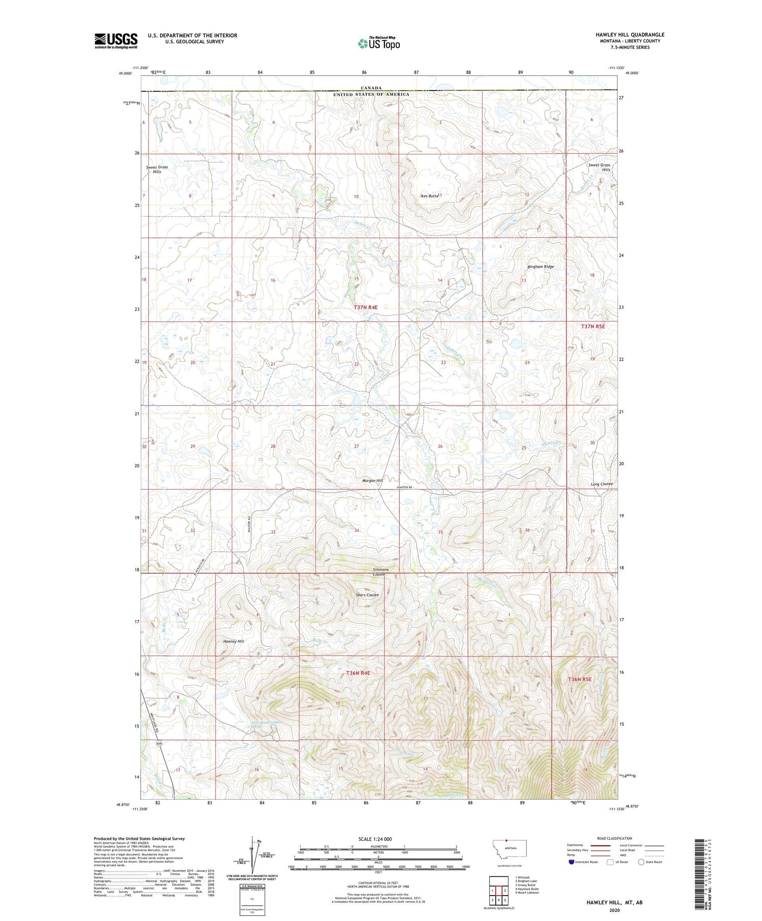
2020 topographic map quadrangle Hawley Hill in the state of Montana. Scale: 1:24000. Based on the newly updated USGS 7.5' US Topo map series, this map is in the following counties: Liberty. The map contains contour data, water features, and other items you are used to seeing on USGS maps, but also has updated roads and other features. This is the next generation of topographic maps. Printed on high-quality waterproof paper with UV fade-resistant inks.
Quads adjacent to this one:
West: Whitlash
East: Bingham Lake
Southeast: Mount Lebanon
South: Haystack Butte
Southwest: Grassy Butte
Contains the following named places: 36N04E05CDAC01 Well, 36N04E08BAAC01 Well, 36N04E09CDDB01 Spring, 36N04E17CAA01_ Well, 37N04E01DDDA01 Well, 37N04E04CBDA01 Well, 37N04E09DADA01 Well, 37N04E10CBCA01 Well, 37N04E11DCCD01 Well, 37N04E12ABCA01 Well, 37N04E14ADAC01 Well, 37N04E14DDAB01 Well, 37N04E15DCDB01 Well, 37N04E22DCAB01 Well, 37N04E23CCDD01 Well, 37N04E26BDCC01 Well, 37N04E35CDDD01 Well, 37N05E30BAD01_ Well, 59545, Bear Gulch School, Bengor Creek, Betelguese Dam, Bingham Ranch, Bingham Ridge, Closed Doors Dam, Dohrs Creek, Dolezal Ranch, Famolare Dam, Franks Creek, Hawley Hill, Ikes Butte, Iverson Ranch, Lakey Ranch, Lauener Ranch, Menkar Dam, Morgan Hill, Morrison Ranch, Mount Brown Mine, Old Hawley Ranch, Parsell Dam, Schafer Ranch, Thompson Ranch, W Parsell Dam, Wallace Ranch, Whitlash Gas and Oil Field