MyTopo
Hayes Point Montana US Topo Map
Couldn't load pickup availability
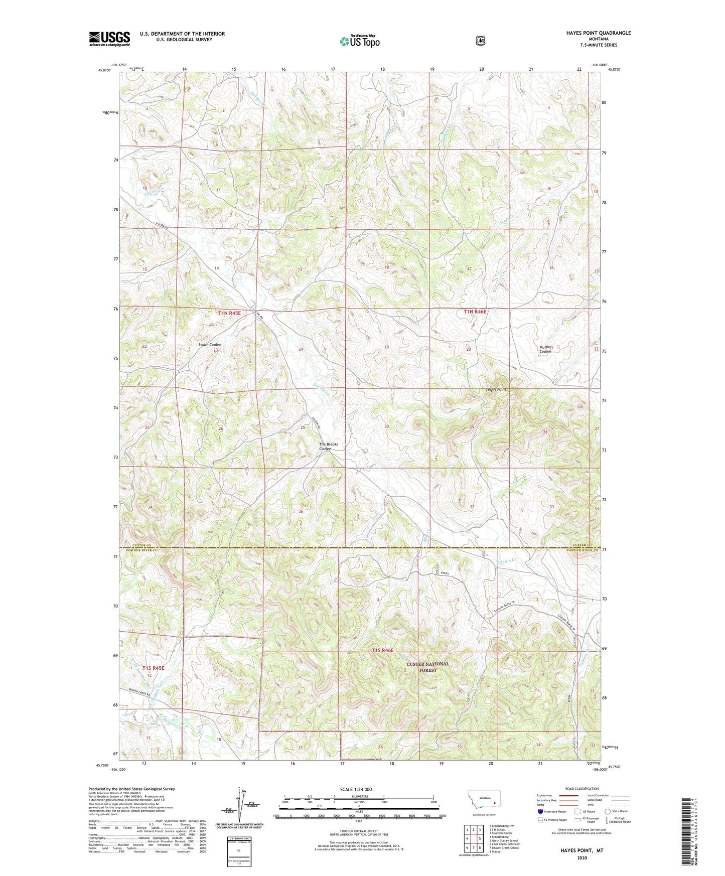
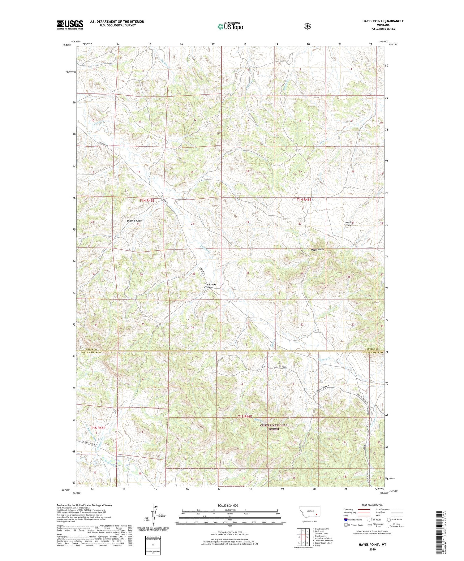
2020 topographic map quadrangle Hayes Point in the state of Montana. Scale: 1:24000. Based on the newly updated USGS 7.5' US Topo map series, this map is in the following counties: Custer, Powder River. The map contains contour data, water features, and other items you are used to seeing on USGS maps, but also has updated roads and other features. This is the next generation of topographic maps. Printed on high-quality waterproof paper with UV fade-resistant inks.
Quads adjacent to this one:
West: Brandenberg
Northwest: Brandenberg NW
North: S H School
Northeast: Fourmile Creek
East: North Stacey School
Southeast: Stacey
South: Beaver Creek School
Southwest: Cook Creek Reservoir
Contains the following named places: 01N46E06ACBC01 Well, 01N46E06BDAD01 Well, 01N46E09DBAA01 Well, 01N46E20DDAD01 Well, 01N46E30BCCB01 Well, 01N46E31DAAC01 Well, 01S45E01CABB01 Well, 01S46E03ACDA01 Well, 01S46E16BAAC01 Well, Creek Number One, Creek Number Two, Hayes Point, Mill Creek, Swain Coulee, The Breaks Coulee