MyTopo
Rimrock Montana US Topo Map
Couldn't load pickup availability
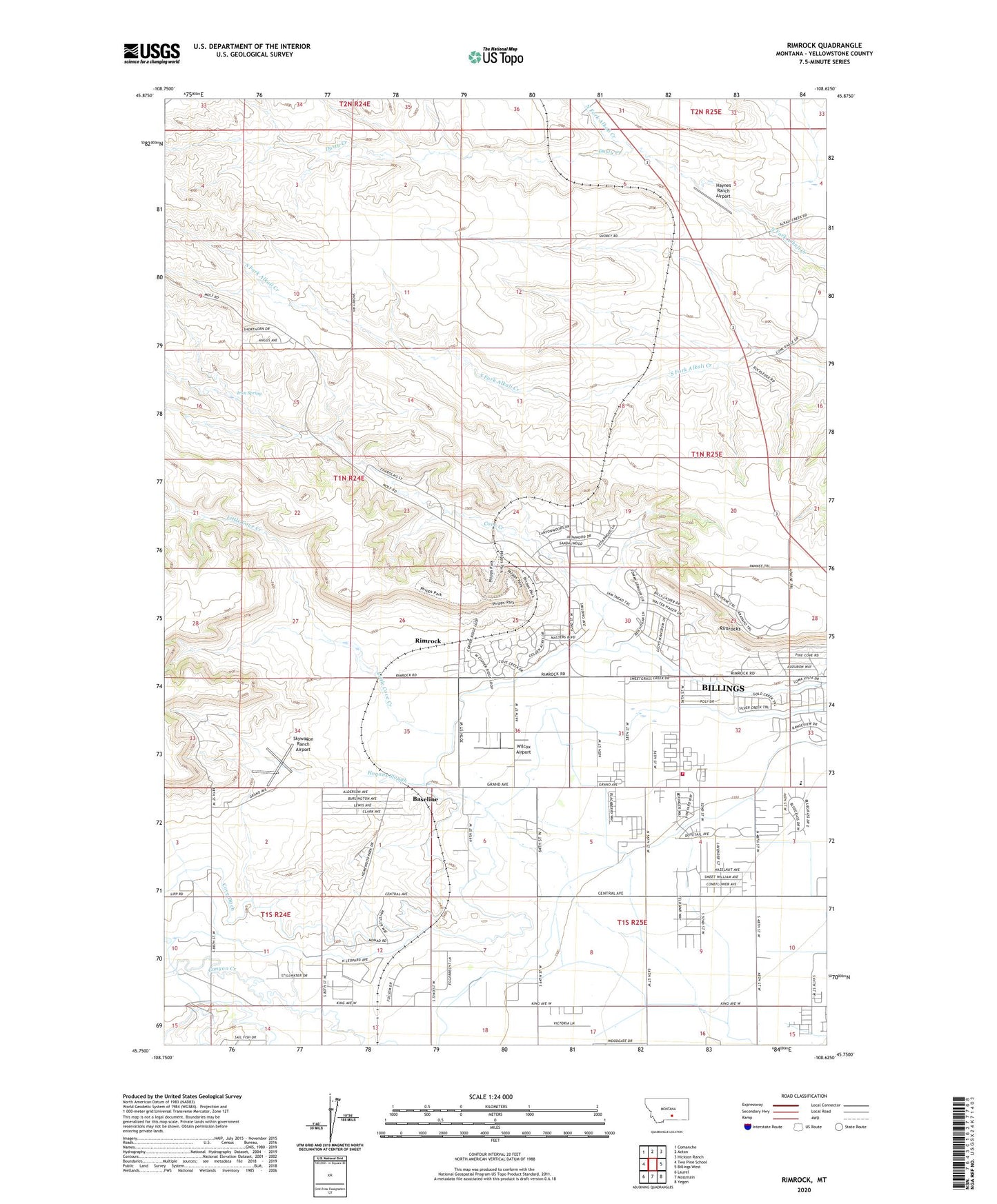
2024 topographic map quadrangle Rimrock in the state of Montana. Scale: 1:24000. Based on the newly updated USGS 7.5' US Topo map series, this map is in the following counties: Yellowstone. The map contains contour data, water features, and other items you are used to seeing on USGS maps, but also has updated roads and other features. This is the next generation of topographic maps. Printed on high-quality waterproof paper with UV fade-resistant inks.
Quads adjacent to this one:
West: Two Pine School
Northwest: Comanche
North: Acton
Northeast: Hickson Ranch
East: Billings West
Southeast: Yegen
South: Mossmain
Southwest: Laurel
This map covers the same area as the classic USGS quad with code o45108g6.
Contains the following named places: 01N24E10C___01 Well, 01N24E11D___01 Well, 01N25E04C___01 Well, 01N25E17CADB01 Well, 01N25E31BABA01 Well, 01N25E32CCCC01 Well, 01S24E13AADD01 Well, 01S24E14AAAD01 Well, 01S24E15AAAB01 Well, 01S25E05CD__01 Well, 01S25E06AABB01 Well, 01S25E08DDCC01 Well, 01S25E09AAAB01 Well, 01S25E09BBBB01 Well, 01S25E15BBAA01 Well, 01S25E17AAAA01 Well, 01S25E17BBBC01 Well, 01S25E18B___01 Well, 59106, Base Line School, Baseline, Billings Fire Department Station 7, Cove Creek, Cove Ditch, Dusty Creek, Haynes Ranch Airport, Husky Ranch Airport, Iran Spring, Little Cove Creek, Rimrock, Stewart Ranch, Wilcox Airport