MyTopo
Hogeland SE Montana US Topo Map
Couldn't load pickup availability
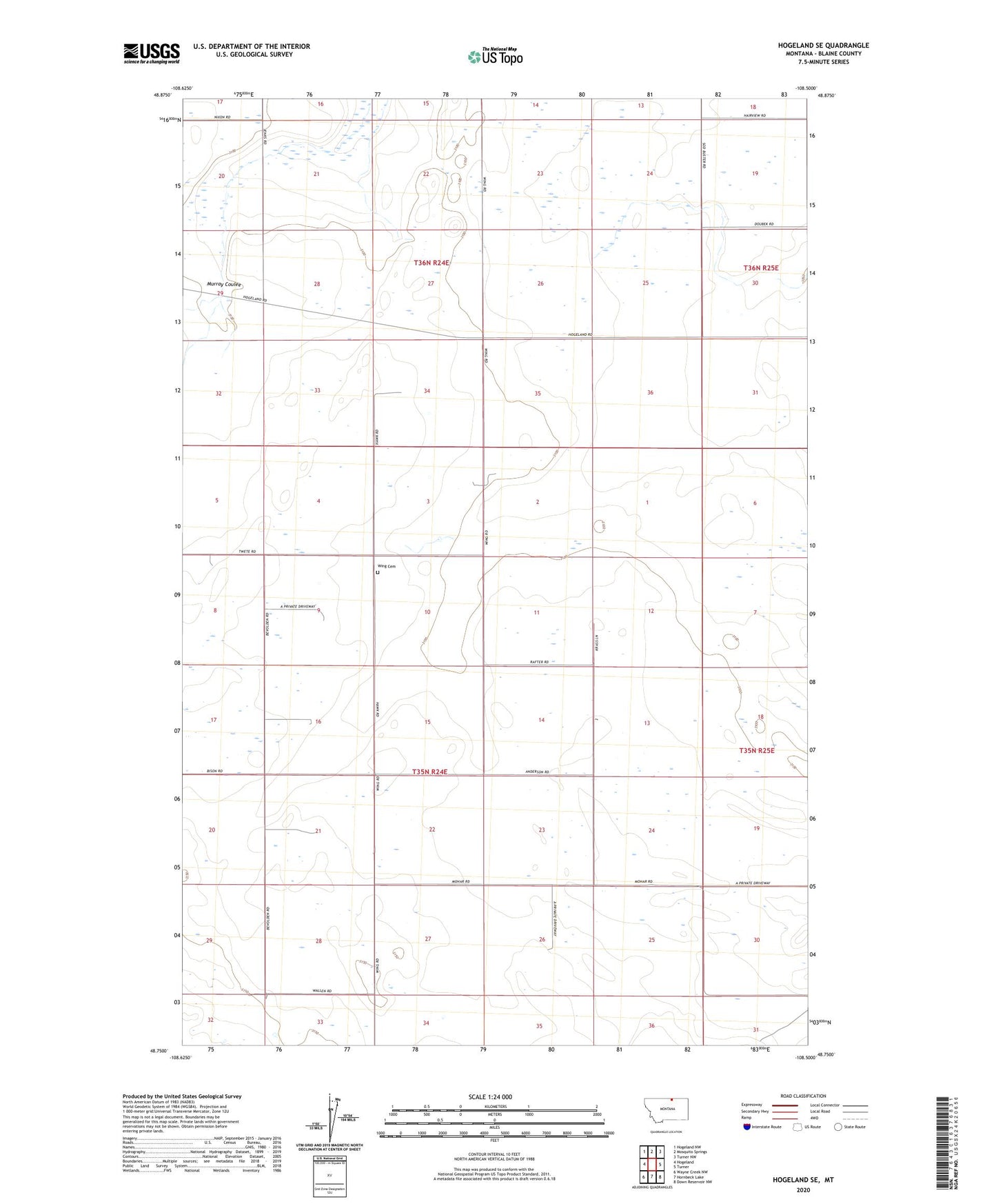
2024 topographic map quadrangle Hogeland SE in the state of Montana. Scale: 1:24000. Based on the newly updated USGS 7.5' US Topo map series, this map is in the following counties: Blaine. The map contains contour data, water features, and other items you are used to seeing on USGS maps, but also has updated roads and other features. This is the next generation of topographic maps. Printed on high-quality waterproof paper with UV fade-resistant inks.
Quads adjacent to this one:
West: Hogeland
Northwest: Hogeland NW
North: Mosquito Springs
Northeast: Turner NW
East: Turner
Southeast: Down Reservoir NW
South: Hornbeck Lake
Southwest: Wayne Creek NW
This map covers the same area as the classic USGS quad with code o48108g5.
Contains the following named places: 35N24E02CBD_01 Well, 35N24E03ABBB01 Well, 35N24E05ADAD01 Well, 35N24E09BDAA01 Well, 35N24E09DBBC01 Well, 35N24E13CCCC01 Well, 35N24E15CCCC01 Well, 36N24E25DADA01 Well, 36N24E26DDDA01 Well, 36N24E35BBBB01 Well, Cherry Patch Post Office, Saint Thomas Aquinas Church, Twete Post Office, Wing, Wing Cemetery, Wing School