MyTopo
Hogeland Montana US Topo Map
Couldn't load pickup availability
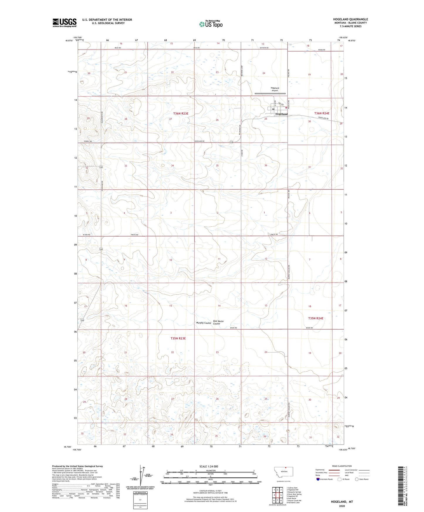
2024 topographic map quadrangle Hogeland in the state of Montana. Scale: 1:24000. Based on the newly updated USGS 7.5' US Topo map series, this map is in the following counties: Blaine. The map contains contour data, water features, and other items you are used to seeing on USGS maps, but also has updated roads and other features. This is the next generation of topographic maps. Printed on high-quality waterproof paper with UV fade-resistant inks.
Quads adjacent to this one:
West: Silver Bow Spring
Northwest: Aubrey Dam
North: Hogeland NW
Northeast: Mosquito Springs
East: Hogeland SE
Southeast: Hornbeck Lake
South: Wayne Creek NW
Southwest: East Butte
This map covers the same area as the classic USGS quad with code o48108g6.
Contains the following named places: 35N23E01DBDD01 Well, 35N24E18BCDD01 Well, 35N24E30AAAC01 Well, 59529, East Butte Coulee, East End School, Harlem Division, Hogeland, Hogeland Airport, Hogeland American Lutheran Church, Hogeland Census Designated Place, Hogeland Post Office, Hogeland Volunteer Fire Department, Murphy Coulee, Silver Bow, Silver Bow School