MyTopo
Hummingbird Peak Montana US Topo Map
Couldn't load pickup availability
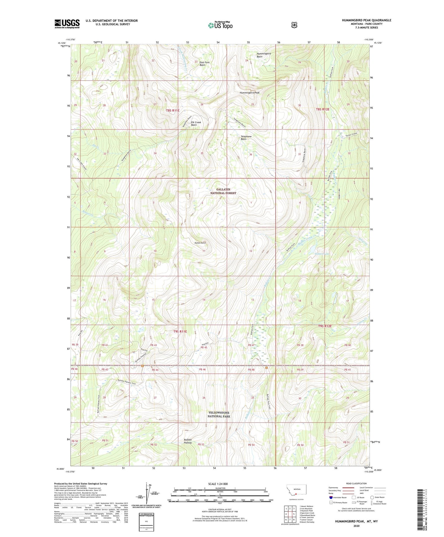
2020 topographic map quadrangle Hummingbird Peak in the state of Montana. Scale: 1:24000. Based on the newly updated USGS 7.5' US Topo map series, this map is in the following counties: Park. The map contains contour data, water features, and other items you are used to seeing on USGS maps, but also has updated roads and other features. This is the next generation of topographic maps. Printed on high-quality waterproof paper with UV fade-resistant inks.
Quads adjacent to this one:
West: Specimen Creek
Northwest: Mount Wallace
North: Iron Mountain
Northeast: Haystack Peak
East: Roundhead Butte
Southeast: Mount Hornaday
South: Lamar Canyon
Southwest: Tower Junction
Contains the following named places: Buffalo Butte, Buffalo Fork Ranger Station, Buffalo Plateau, Buffalo Plateau Patrol Cabin, Cat Creek, East Fork Basin, Elk Creek Basin, Grassy Creek, Hidden Lake, Hummingbird Basin, Hummingbird Peak, Poacher Trail, Silver Creek, Telephone Basin