MyTopo
Iron Mountain Montana US Topo Map
Couldn't load pickup availability
Also explore the Iron Mountain Forest Service Topo of this same quad for updated USFS data
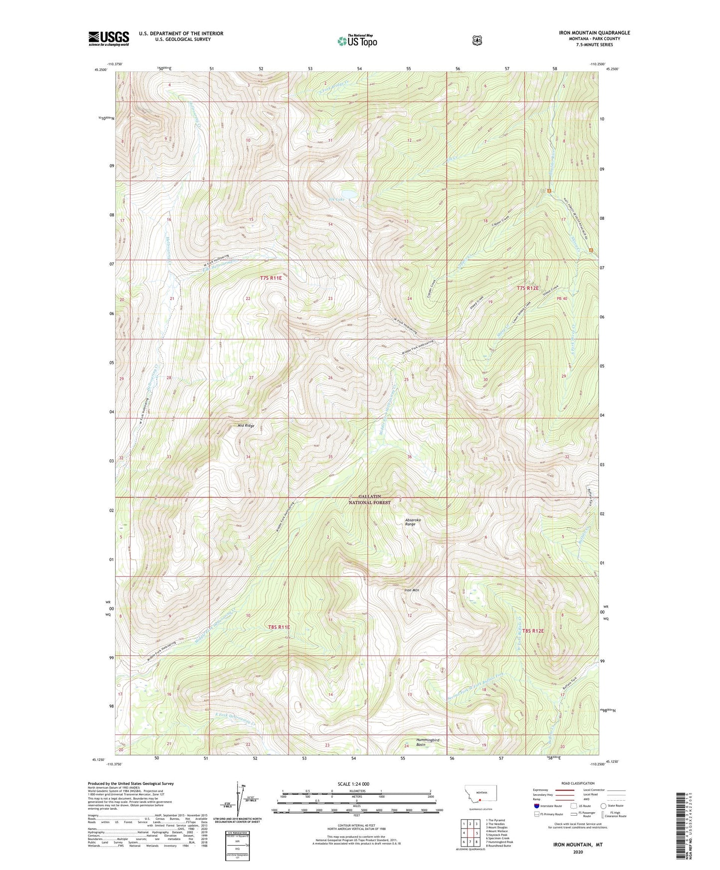
2024 topographic map quadrangle Iron Mountain in the state of Montana. Scale: 1:24000. Based on the newly updated USGS 7.5' US Topo map series, this map is in the following counties: Park. The map contains contour data, water features, and other items you are used to seeing on USGS maps, but also has updated roads and other features. This is the next generation of topographic maps. Printed on high-quality waterproof paper with UV fade-resistant inks.
Quads adjacent to this one:
West: Mount Wallace
Northwest: The Pyramid
North: The Needles
Northeast: Mount Douglas
East: Haystack Peak
Southeast: Roundhead Butte
South: Hummingbird Peak
Southwest: Specimen Creek
This map covers the same area as the classic USGS quad with code o45110b3.
Contains the following named places: Basin Creek, Copper Creek, East Branch Hellroaring Creek, East Fork Buffalo Fork, Elk Creek, Elk Lake, Iron Mountain, Maxwell Post Office, Middle Ridge, Second Fork West Fork Buffalo Fork, Sheep Creek, South Fork Sheep Creek, West Fork Buffalo Creek