MyTopo
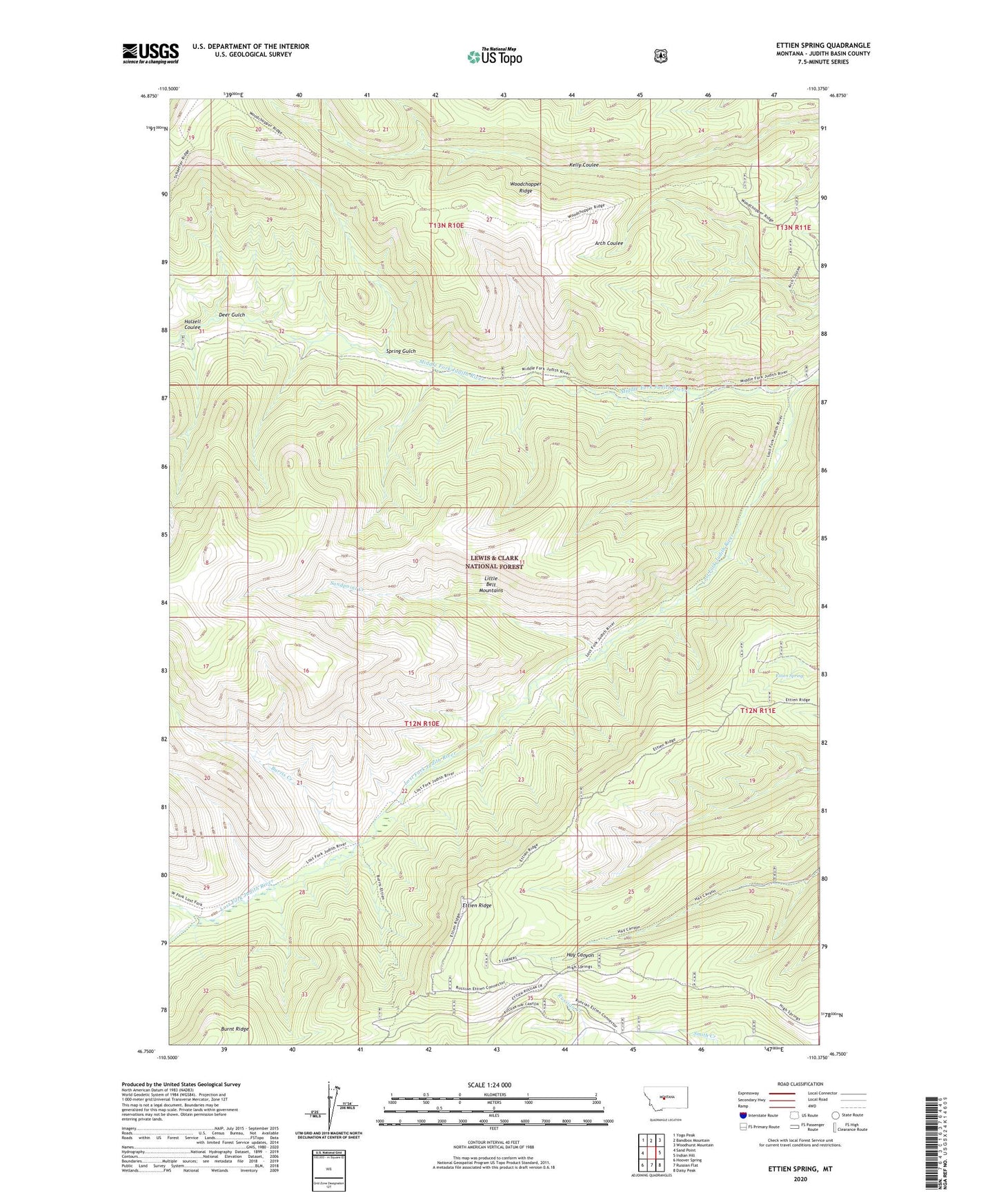
Ettien Spring Montana US Topo Map
Couldn't load pickup availability
Also explore the Ettien Spring Forest Service Topo of this same quad for updated USFS data
2024 topographic map quadrangle Ettien Spring in the state of Montana. Scale: 1:24000. Based on the newly updated USGS 7.5' US Topo map series, this map is in the following counties: Judith Basin. The map contains contour data, water features, and other items you are used to seeing on USGS maps, but also has updated roads and other features. This is the next generation of topographic maps. Printed on high-quality waterproof paper with UV fade-resistant inks.
Quads adjacent to this one:
West: Sand Point
Northwest: Yogo Peak
North: Bandbox Mountain
Northeast: Woodhurst Mountain
East: Indian Hill
Southeast: Daisy Peak
South: Russian Flat
Southwest: Hoover Spring
This map covers the same area as the classic USGS quad with code o46110g4.
Contains the following named places: Burris Cabin, Burris Creek, Deer Gulch, Ettien Ridge, Ettien Spring, Halzell Coulee, Korell Cabin, Lost Fork Judith River, Sandpoint Creek, South Fork Lost Fork Judith River, Spring Gulch, West Fork Lost Fork