MyTopo
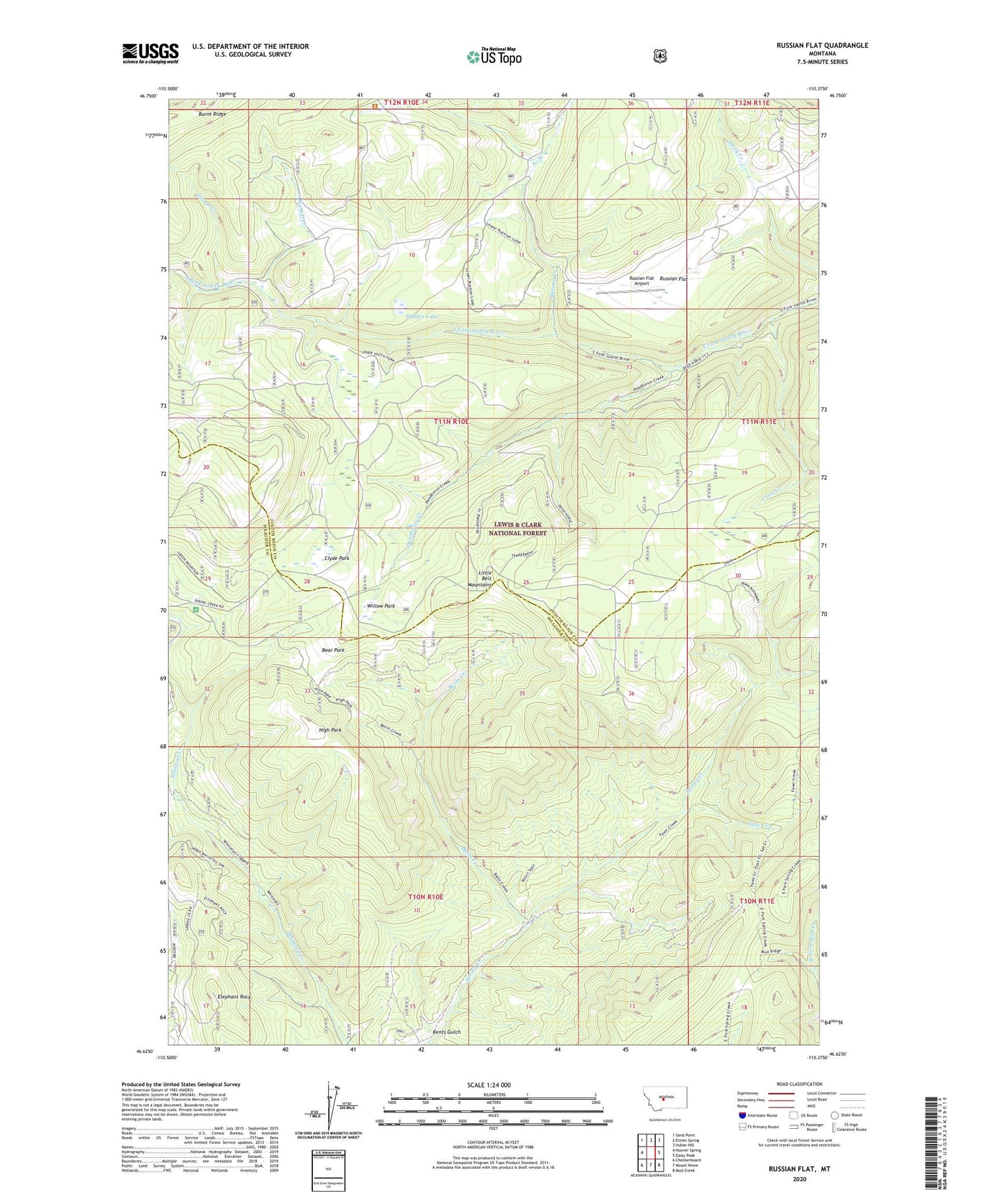
Russian Flat Montana US Topo Map
Couldn't load pickup availability
Also explore the Russian Flat Forest Service Topo of this same quad for updated USFS data
2024 topographic map quadrangle Russian Flat in the state of Montana. Scale: 1:24000. Based on the newly updated USGS 7.5' US Topo map series, this map is in the following counties: Meagher, Judith Basin. The map contains contour data, water features, and other items you are used to seeing on USGS maps, but also has updated roads and other features. This is the next generation of topographic maps. Printed on high-quality waterproof paper with UV fade-resistant inks.
Quads adjacent to this one:
West: Hoover Spring
Northwest: Sand Point
North: Ettien Spring
Northeast: Indian Hill
East: Daisy Peak
Southeast: Mud Creek
South: Mount Howe
Southwest: Checkerboard
This map covers the same area as the classic USGS quad with code o46110f4.
Contains the following named places: Basin Creek, Basin Creek Campground, Bear Park, Big Hill Creek, Clyde Park, Corral Creek, Cross Creek, Deadhorse Creek, Elephant Rock, Fawn Creek, Hidden Lake, High Park, Hunter Spring Guard Station, Jumbo Mine, Kents Gulch, Lucky Boy Mine, New Deal Mine, NW NE Section 15 Mine, Russian Creek, Russian Flat, Russian Flat Airport, SW NW Section 15 Mine, Willow Park