MyTopo
Iris Point Montana US Topo Map
Couldn't load pickup availability
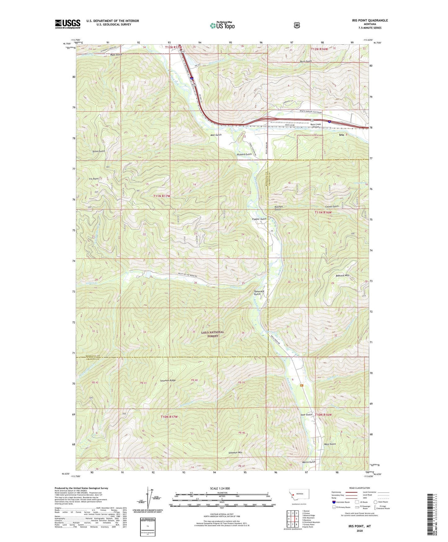
2020 topographic map quadrangle Iris Point in the state of Montana. Scale: 1:24000. Based on the newly updated USGS 7.5' US Topo map series, this map is in the following counties: Missoula, Granite. The map contains contour data, water features, and other items you are used to seeing on USGS maps, but also has updated roads and other features. This is the next generation of topographic maps. Printed on high-quality waterproof paper with UV fade-resistant inks.
Quads adjacent to this one:
West: Elk Mountain
Northwest: Bonner
North: Clinton
Northeast: Mineral Ridge
East: Ravenna
Southeast: Spink Point
South: Grizzly Point
Southwest: Cleveland Mountain
Contains the following named places: 11N16W06CCDD01 Well, 11N16W06CCDD02 Well, 11N16W06CDCD01 Well, 11N16W06CDCD02 Well, 11N16W07AAAA01 Well, 11N16W07AAAA02 Well, 11N16W08ABBA01 Well, 11N16W08ABBA02 Well, 11N16W08ADAB01 Well, 11N16W08BAD_01 Well, 11N16W08BDA_01 Well, 11N17W02ABB_01 Well, 11N17W02ABCB01 Well, 11N17W02ACBA01 Well, 11N17W02ACBD01 Well, 11N17W02ACDC01 Well, 11N17W02CADA01 Well, 11N17W12ADDD01 Well, 11N17W12ADDD02 Well, 12N17W34DCAD01 Well, 12N17W34DDAC01 Well, 12N17W34DDBD01 Well, 12N17W34DDCB01 Well, Babcock Creek, Babcock Mountain, Bonita Forest Service Station, Bonita Work Center, Burn Gulch, Clinton Rest Area, Colma Gulch, Colma Spring, Ekstroms Stage Station, Elkhorn Guest Ranch, Fiddler Gulch, Finlen Ranch, Gilbert Creek, Goat Creek, Ione Gulch, Iris, Iris Point, Iris Point Trail, Kitchen Gulch, Laub, Matt Gulch, Mecca Gulch, Moe Gulch, North Fork Gilbert Creek, Pineland Post Office, Pollocks JH Valley of the Moon Dam, Rickard Gulch, Rock Creek, Rock Creek Airport, Rock Creek Lodge, Scepter, Solomon Creek, Solomon Mountain, Solomon Ridge, Solomon Ridge Trail, Solomon Sportsmans Access, South Fork Gilbert Creek, Spring Creek, Starvation Creek, Tamarack Creek Fishing Access Site, Tamarack Gulch, Valley of the Moon Sportmans Access, Welcome Creek Wilderness Historical Marker, West Gulch